Heading into this day, there looked as though there would be some sort of severe weather potential, but the quality and whether or not it would be chase worthy was in question. One of the bigger concerns was lingering rain and t'storms that were to weaken, along with cloud debris from this activity.
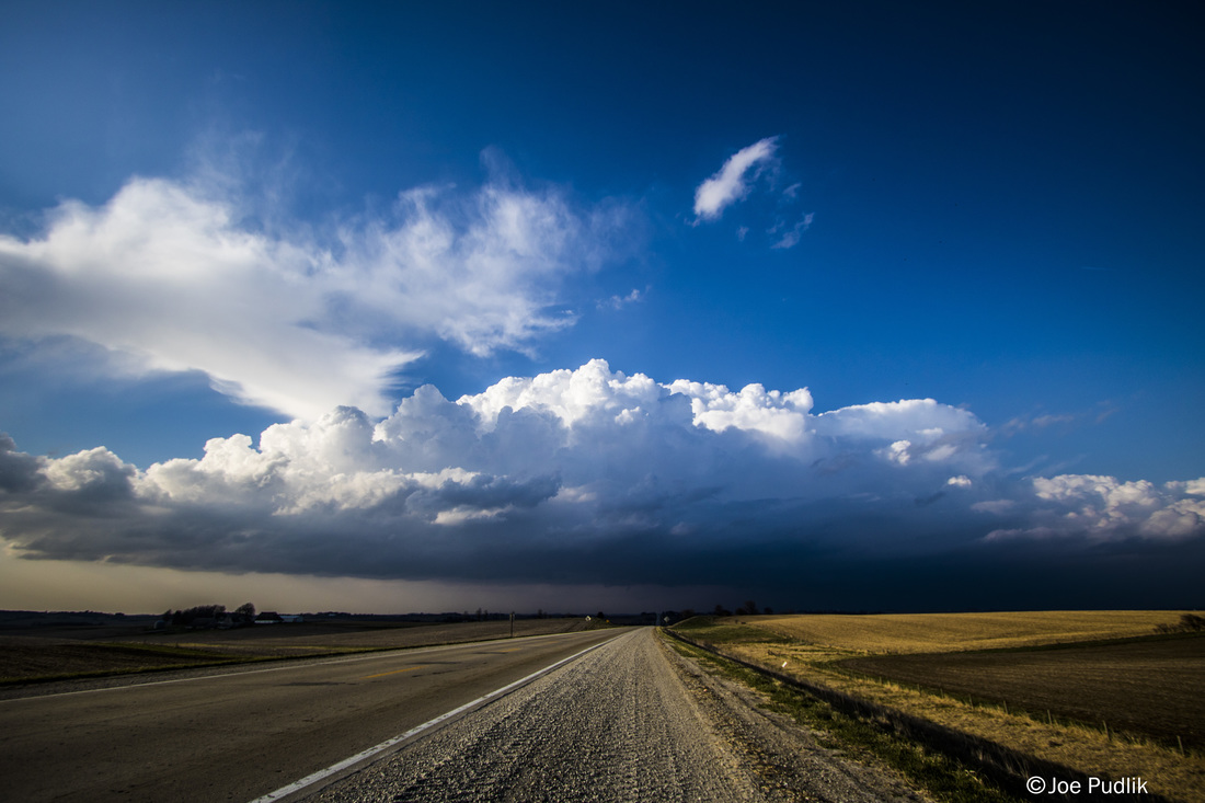
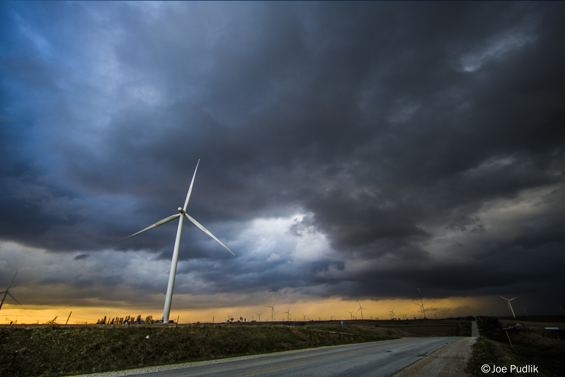
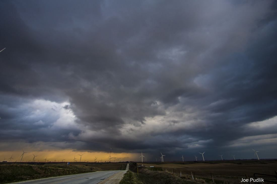
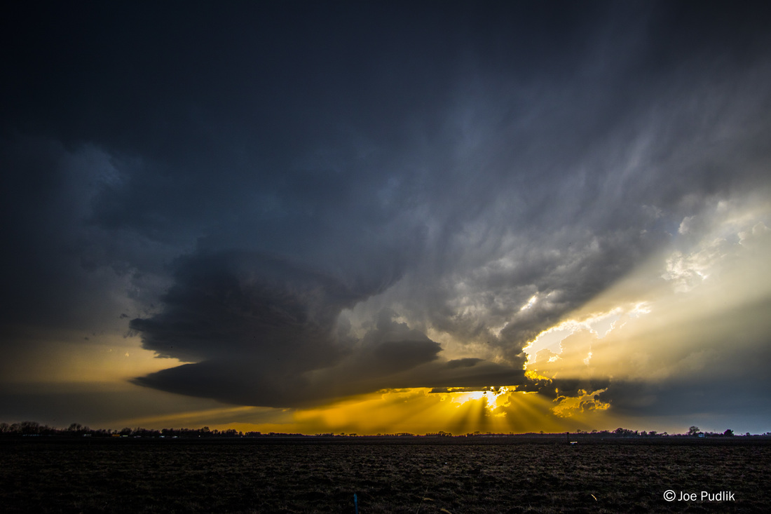
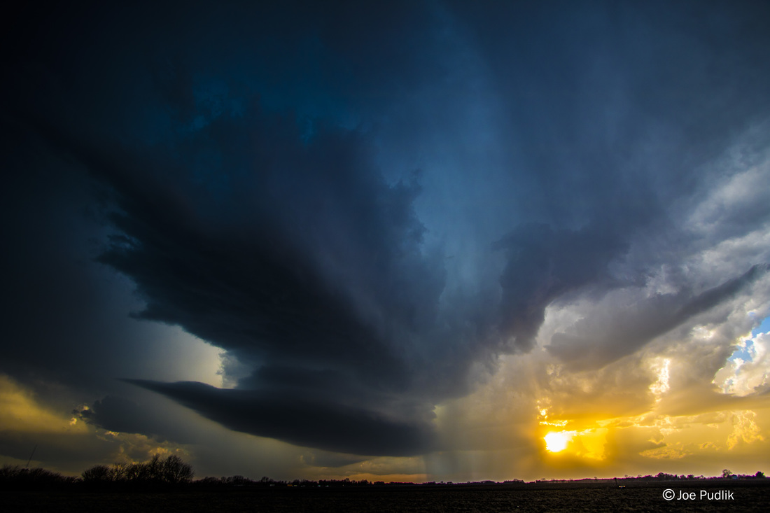
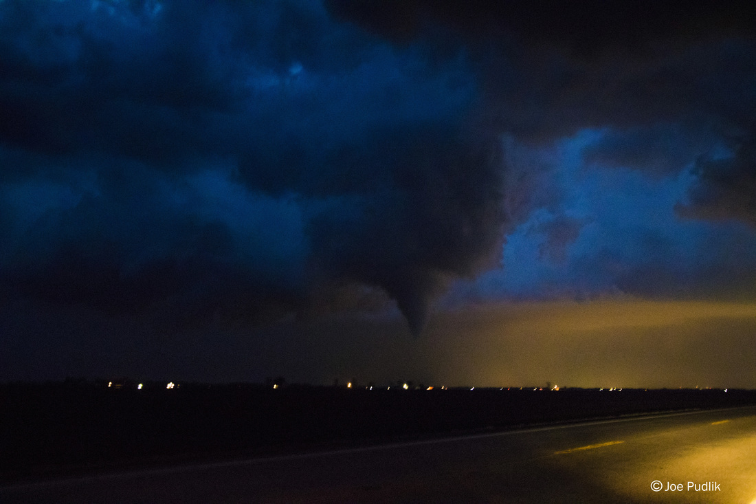
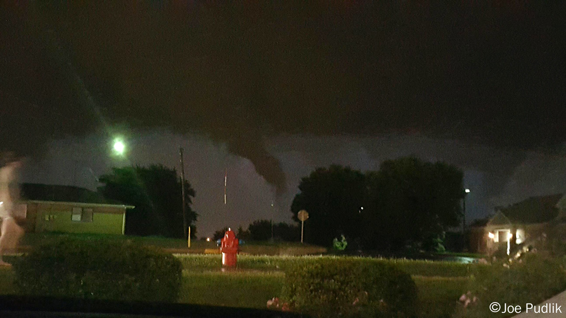
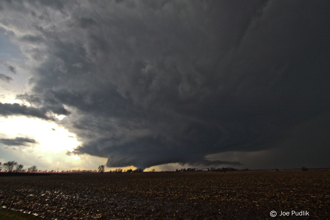
It ended up looking good enough for me to head west to Dixon, IL late in the morning. The warm front/triple point area looked like the main play across NW/NC. Illinois. The environment in place was featuring decent instability, good moisture and great shear, plus there was much more clearing then expected as well. I got out to Dixon during the early afternoon and was sitting there for a bit, when clouds and rain redeveloped over a large area and streamed back northeast across W. IL and further north, killing any potential threat. After sitting in Dixon for several hours watching all of this evolve, I decided to call it a chase and head home. Upon arriving home a line of t'storm did developed across Central Illinois, within the rain and cloud debris that had moved it...but no severe t'storms occurred.
It ended up looking good enough for me to head west to Dixon, IL late in the morning. The warm front/triple point area looked like the main play across NW/NC. Illinois. The environment in place was featuring decent instability, good moisture and great shear, plus there was much more clearing then expected as well. I got out to Dixon during the early afternoon and was sitting there for a bit, when clouds and rain redeveloped over a large area and streamed back northeast across W. IL and further north, killing any potential threat. After sitting in Dixon for several hours watching all of this evolve, I decided to call it a chase and head home. Upon arriving home a line of t'storm did developed across Central Illinois, within the rain and cloud debris that had moved it...but no severe t'storms occurred.
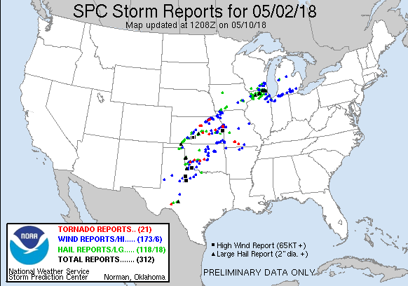
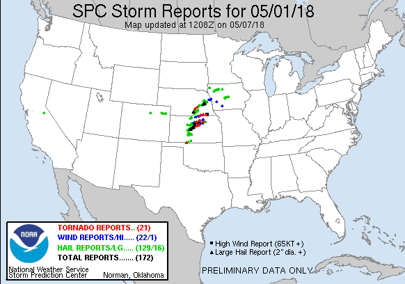
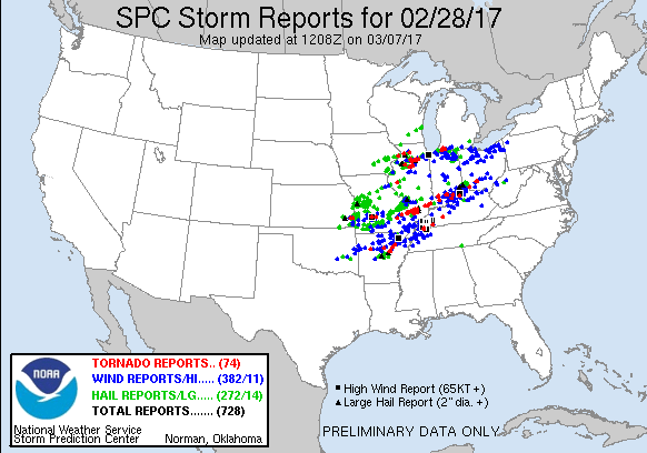
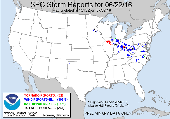
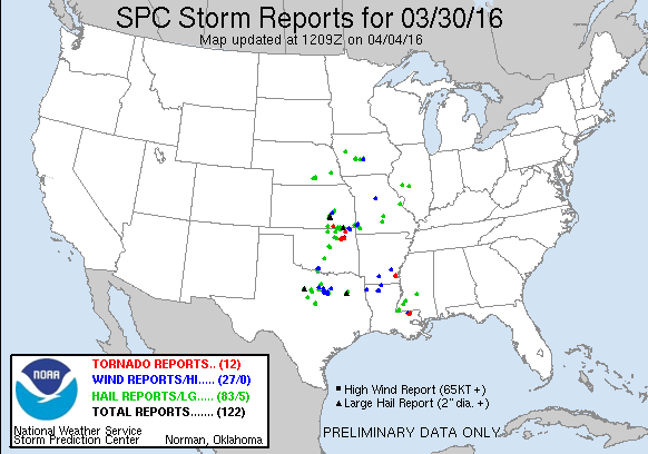
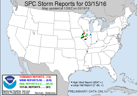
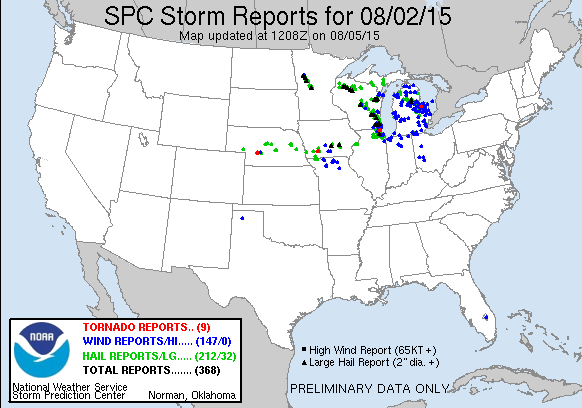
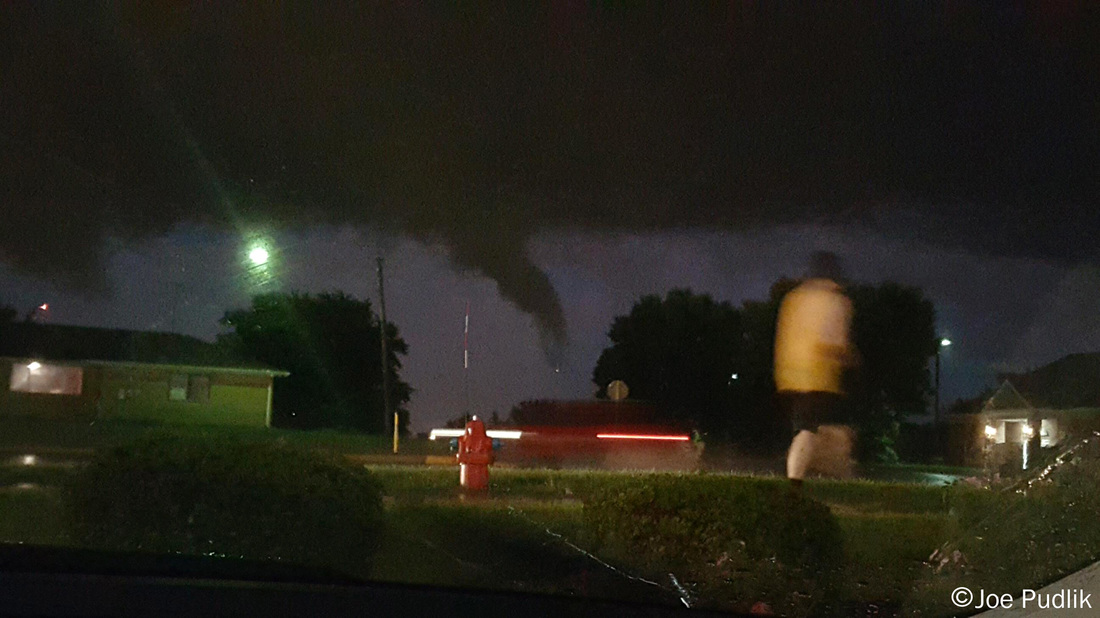
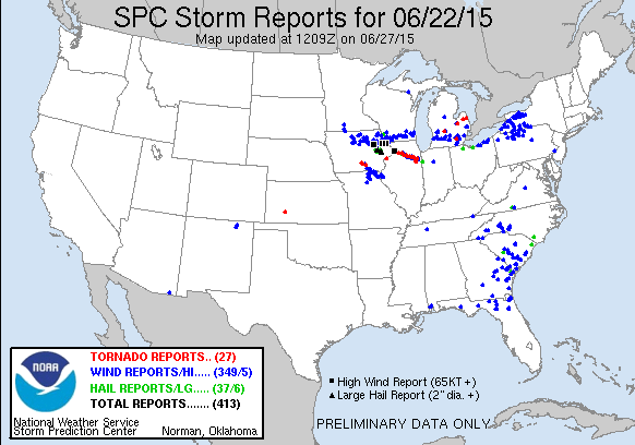
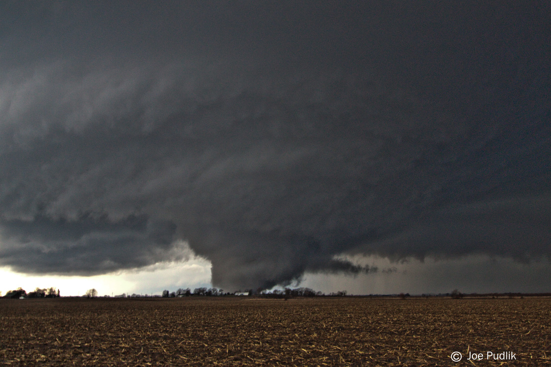
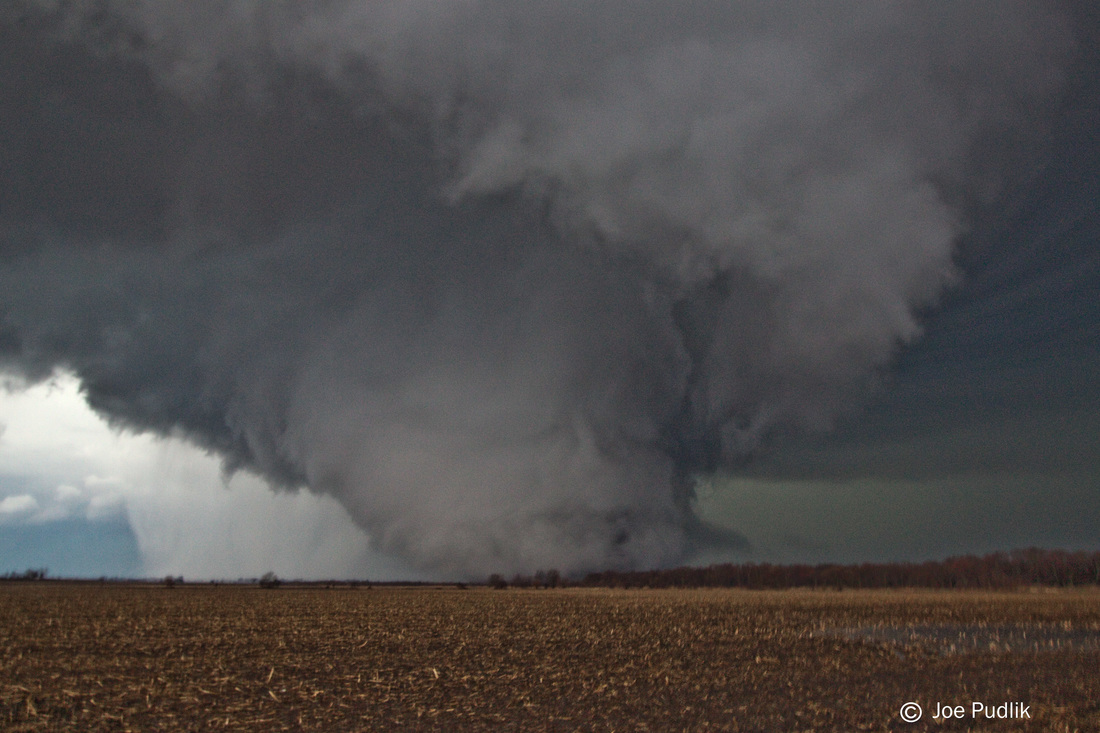
| Chase Statistics: Tornadoes: 0 Wind: None Hail: None | SPC Severe Weather Reports:  |

 RSS Feed