For several days leading up to this day, severe t'storms looked likely across a large portion of the Central US, including the potential for a severe weather outbreak. One of the big questions heading into the day of would be; would there be an earlier day round of activity that would develop, and how would it impact the overall risk across IA/MO/IL. Also, there was some questions regarding storm mode, and how long activity would stay more discrete. My plan early in the morning the day of was to leave home by 12PM and head west towards Galesburg IL, to await expected supercell t'storm development in IA/MO. This activity would quickly cross the Mississippi River, in which I would intercept on the IL side.
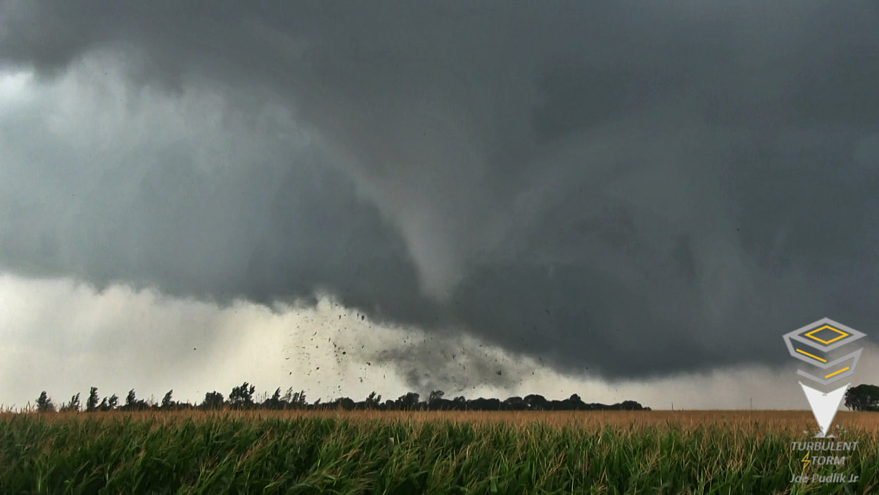
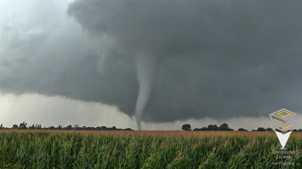
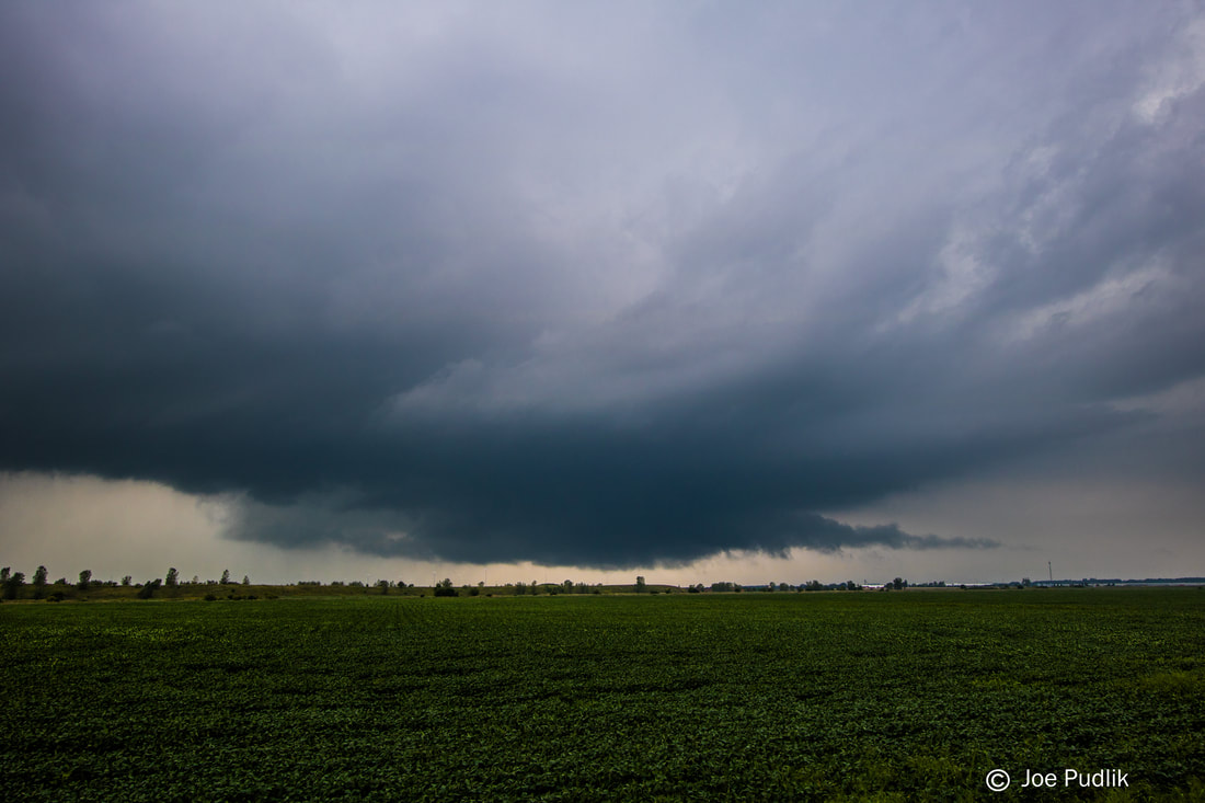
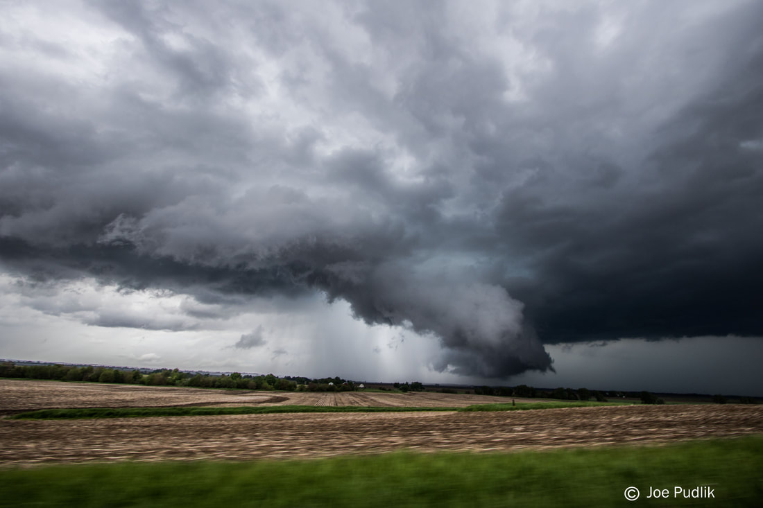
During the early morning a lead wave within the main apparent trough overspread the open warm sector. This allowed a broken cluster of showers and t'storms to develop across portions of OK/KS/MO. For a while this activity struggled to mature, but by later morning it was thriving, as it traversed the heart of Missouri. Running a bit late, I didn't leave home and hit the road until around 12:45PM, but still had a "sit and wait" target of Galesburg. By this time the cluster of now severe t'storm activity traversing parts of Missouri had begun to spread into far Western Illinois. At this time I had no plans to make a play on this activity, as it was quickly moving northeast along the leading edge of moisture/instability advecting in from the south. While driving east on I-88 something was telling me to drop south on I-39, and then continue west towards Galesburg. I didn't listen, and kept rolling west on I-88 to Sterling, where I dropped south on Route 40, with eventual plans to then take Route 34 to the Galesburg area. After a short time of being on Route 40, one of the discrete severe t'storms in the cluster in Western Illinois became tornado warned, as it approached the Peoria area. At this point I had a very quick decision to make, continue to the Galesburg area to wait for developing IA/MO supercell t'storms to move in, or try to quickly drop southeast ahead of the activity approaching Peoria. Making it to I-80, I made the decision to backtrack east on I-80, and then drop south on I-39, to make a play on the tornado warned supercell t'storm moving into the Peoria area. (Now we go back to when I originally was driving on I-88 heading west earlier when something was telling me to drop south on I-39 then...If I would have done so, I would have been able to make a play on the Peoria activity sooner, if I had decided to do so.) I gained visual on the tornado warned supercell t'storm near Waldo IL, which is just off I-39 to the east and just north of Route 24. While watching, this tornado warned supercell t'storm began to struggle, and lost quality radar and visual structure. Continuing east-northeast with this tornado warned supercell t'storm for a bit into the Pontiac IL area, it failed to recover and I decided to end pursuit.
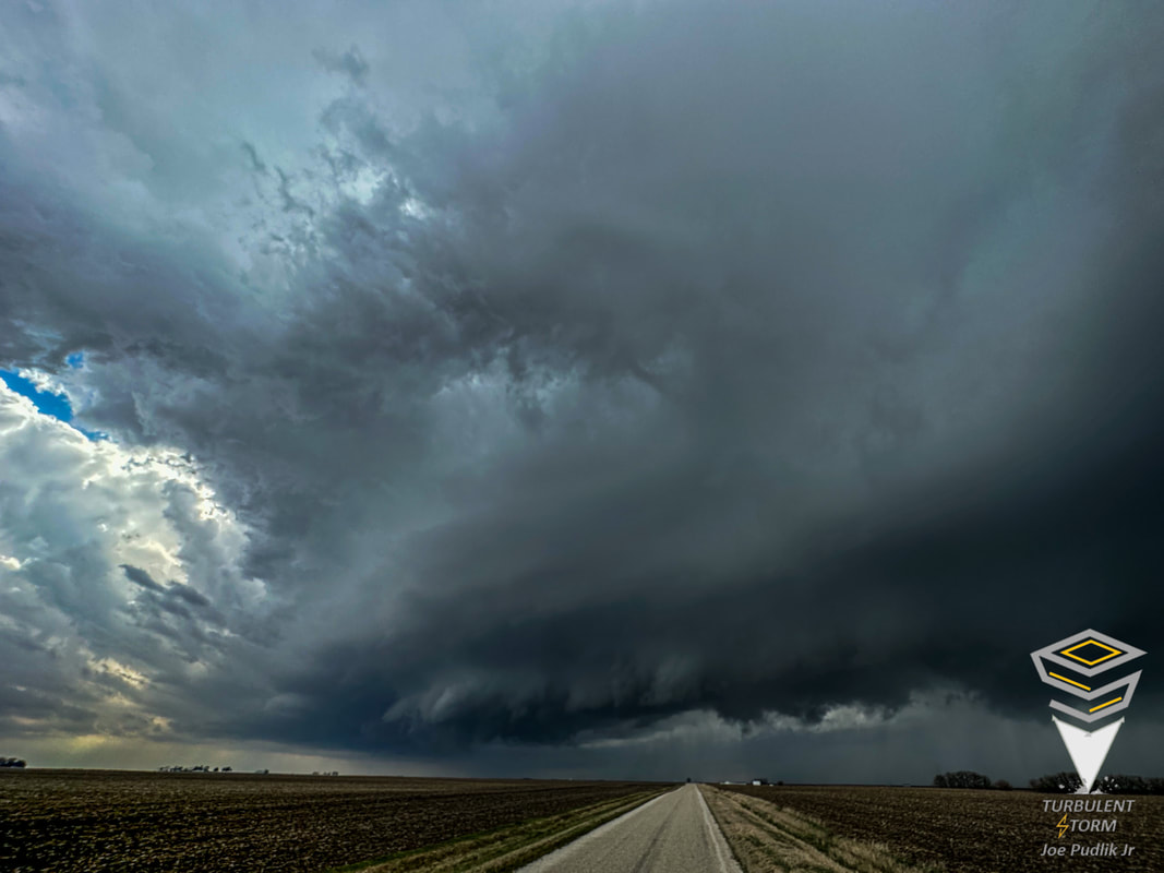
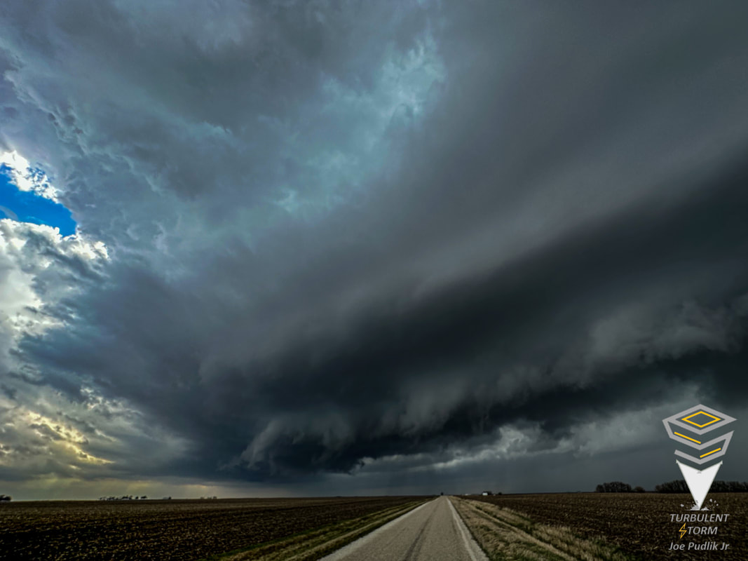
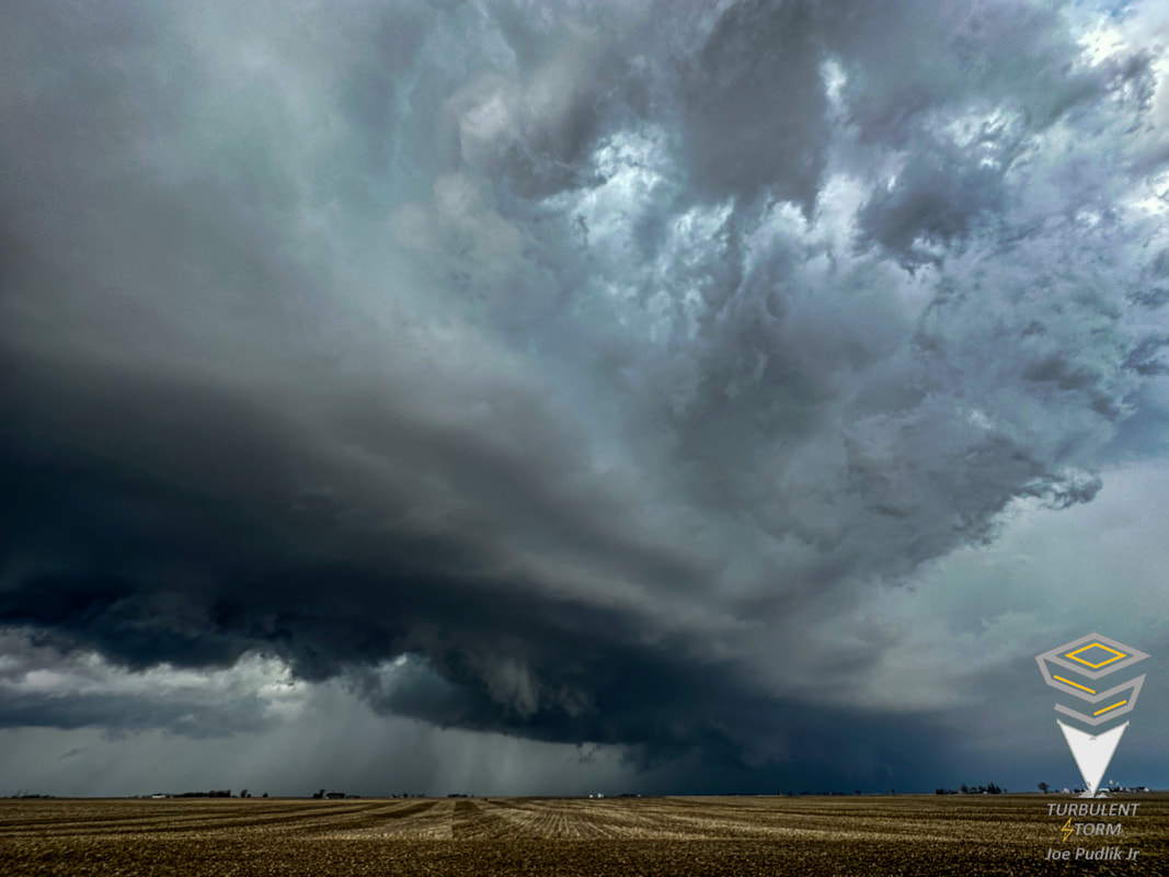
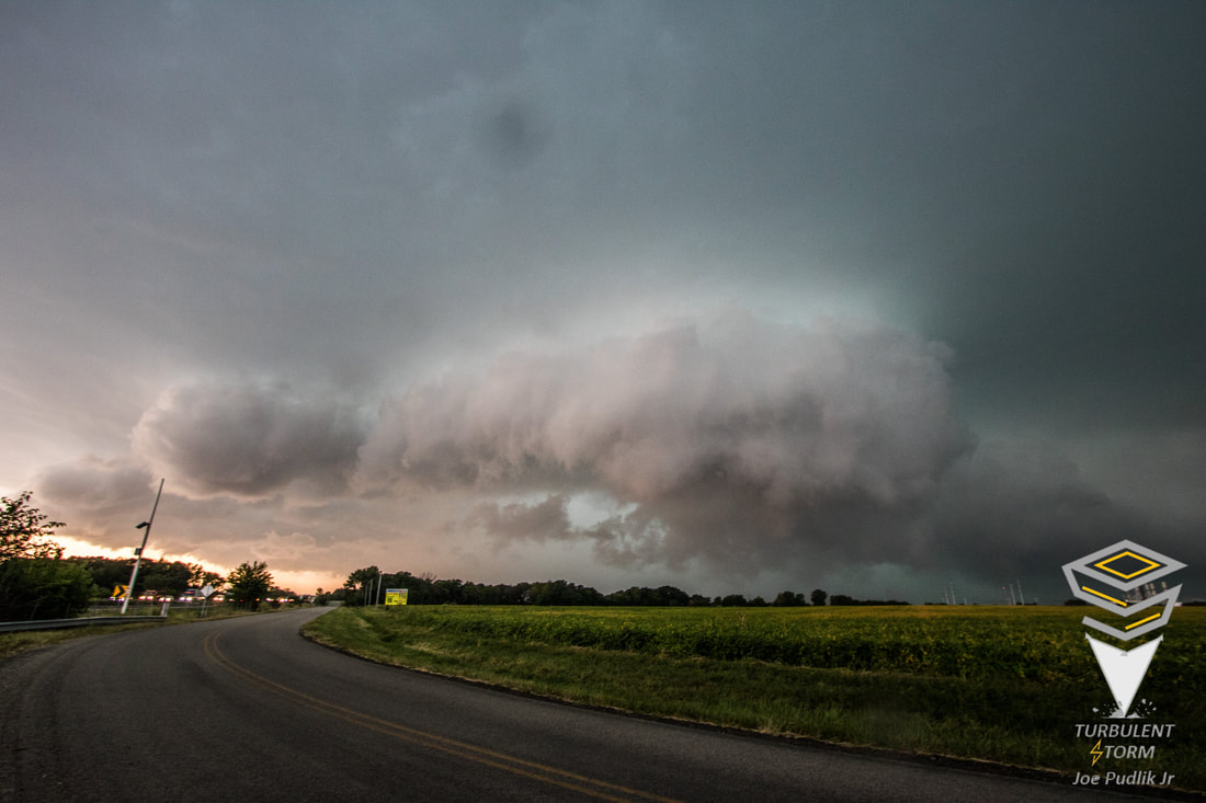
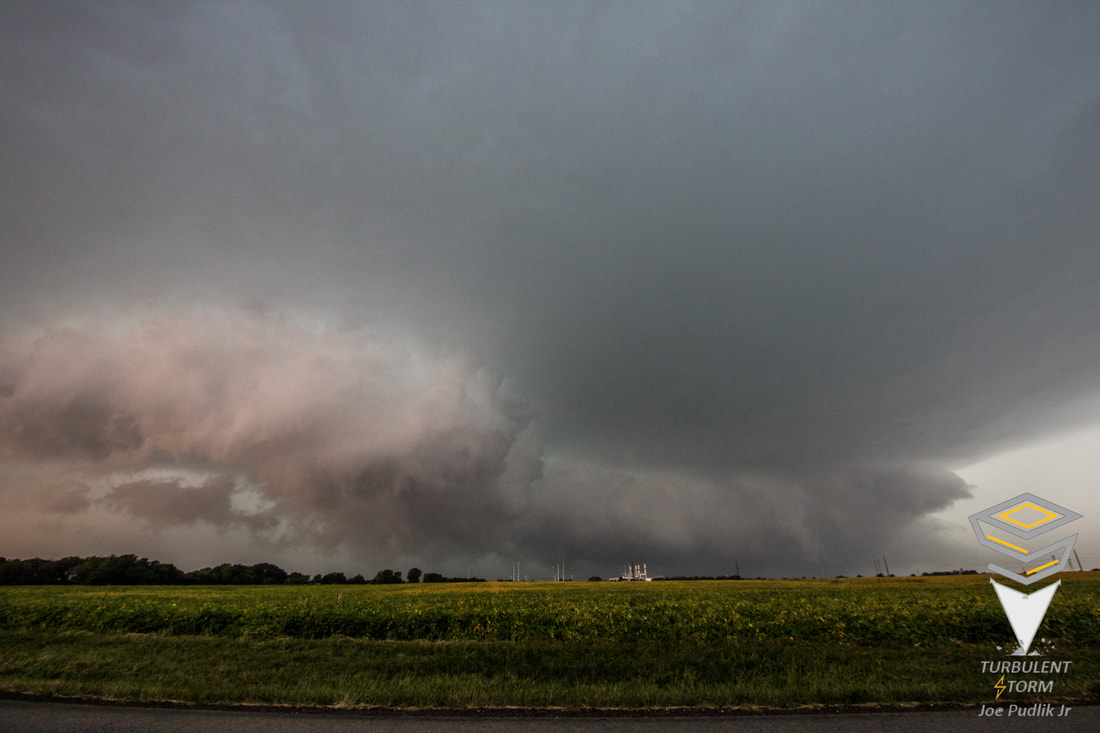
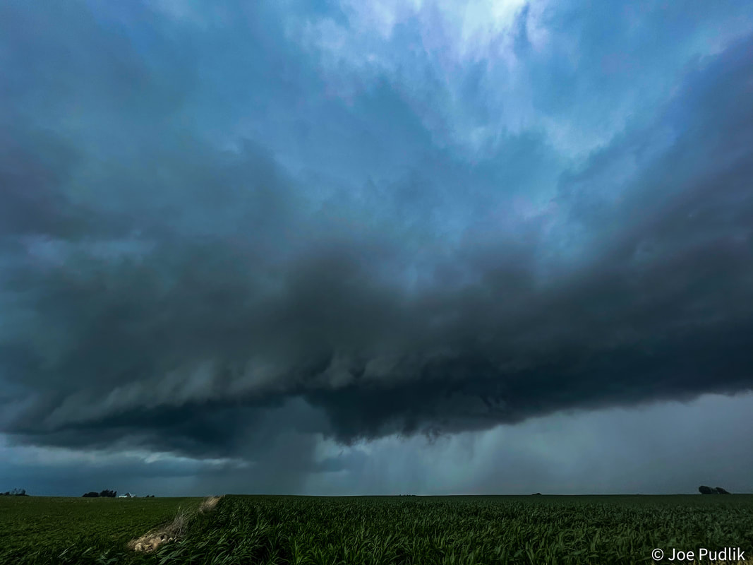
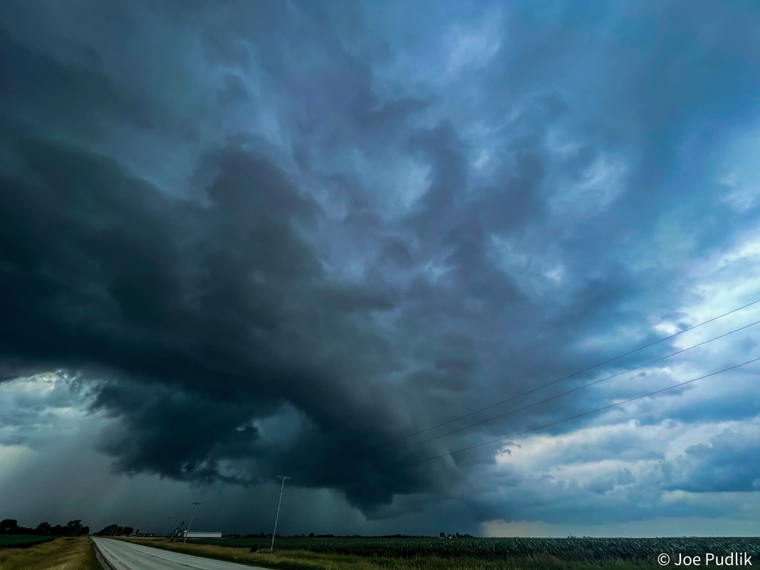
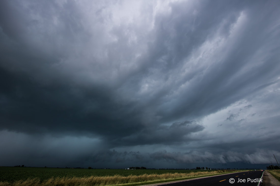
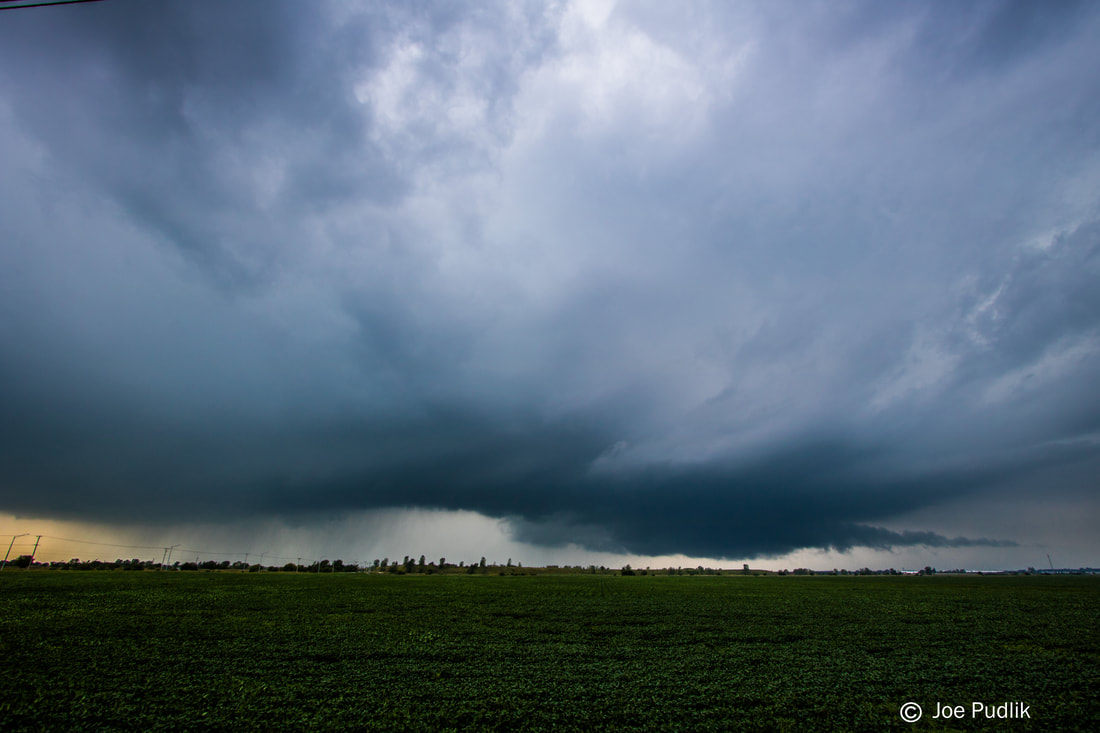
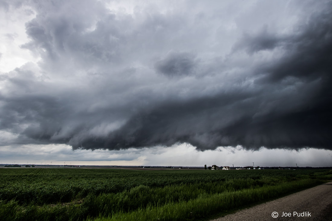
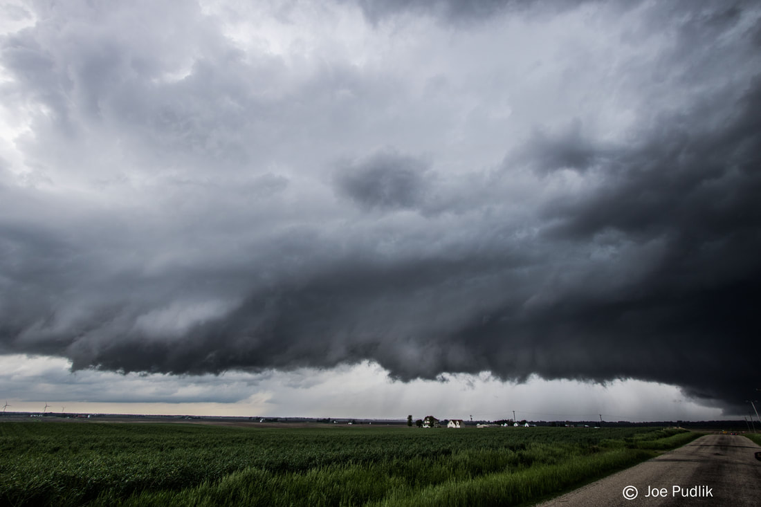
At this time I was left with a decision...A few severe and tornado warned supercell t'storms were back up north in the vicinity of I-80 in Northern Illinois (One near my original target of Galesburg), out west a supercell t'storm in Northeast Missouri had recently diminished, and to the southwest a tornado warned supercell t'storm coming into the Quincy area of Western Illinois was looking like it may congeal into a line with activity developing to it's south. I decided it made sense to head north to the activity approaching I-80, as it was back in the direction of home anyway. I caught up to one of the severe warned supercells t'storms as it approached Hinckley IL. This severe warned supercell t'storm was slightly north of an outflow boundary left behind by a lead supercell t'storm that had recently moved through the area. Sitting and watching, this supercell t'storm started to improve visual and radar structure as it moved east-northeast. Traveling east-northeast along with it as it moved through Sugar Grove IL and into the Western Chicago Suburbs, it gave an attempt at tightening up, but never could fully do it. I decided to end pursuit and head back west towards Hinckley IL, with eyes set on dinner and getting in position to get rolled by an approaching severe and tornado warned QLCS. After heading back west and having a bite to eat, the QLCS moving in from the west was still severe and tornado tornado warned, as there were several meso-vorts showing up within the line. Taking a short hop to the southeast side of Hinckley IL, I sat as the QLCS approached with a very tall and structured shelf cloud. It quickly hit, but didn't pack the expected punch at my location, with 55-60MPH wind gusts. At this point the day was over, and I headed home.
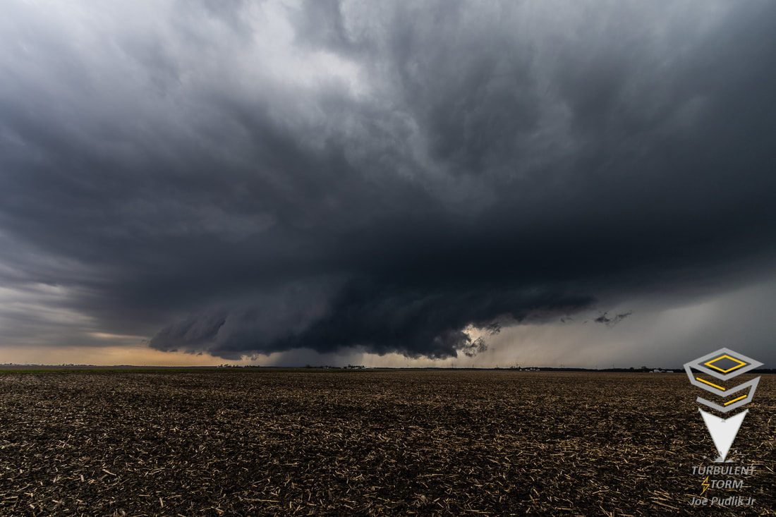
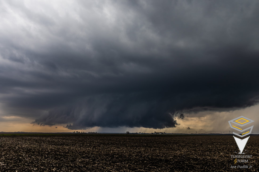
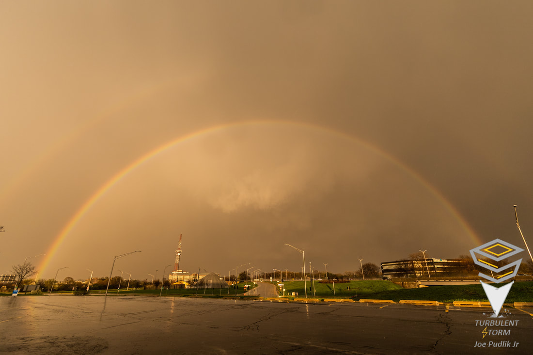
Some pictures from this chase can be viewed below.
During the early morning a lead wave within the main apparent trough overspread the open warm sector. This allowed a broken cluster of showers and t'storms to develop across portions of OK/KS/MO. For a while this activity struggled to mature, but by later morning it was thriving, as it traversed the heart of Missouri. Running a bit late, I didn't leave home and hit the road until around 12:45PM, but still had a "sit and wait" target of Galesburg. By this time the cluster of now severe t'storm activity traversing parts of Missouri had begun to spread into far Western Illinois. At this time I had no plans to make a play on this activity, as it was quickly moving northeast along the leading edge of moisture/instability advecting in from the south. While driving east on I-88 something was telling me to drop south on I-39, and then continue west towards Galesburg. I didn't listen, and kept rolling west on I-88 to Sterling, where I dropped south on Route 40, with eventual plans to then take Route 34 to the Galesburg area. After a short time of being on Route 40, one of the discrete severe t'storms in the cluster in Western Illinois became tornado warned, as it approached the Peoria area. At this point I had a very quick decision to make, continue to the Galesburg area to wait for developing IA/MO supercell t'storms to move in, or try to quickly drop southeast ahead of the activity approaching Peoria. Making it to I-80, I made the decision to backtrack east on I-80, and then drop south on I-39, to make a play on the tornado warned supercell t'storm moving into the Peoria area. (Now we go back to when I originally was driving on I-88 heading west earlier when something was telling me to drop south on I-39 then...If I would have done so, I would have been able to make a play on the Peoria activity sooner, if I had decided to do so.) I gained visual on the tornado warned supercell t'storm near Waldo IL, which is just off I-39 to the east and just north of Route 24. While watching, this tornado warned supercell t'storm began to struggle, and lost quality radar and visual structure. Continuing east-northeast with this tornado warned supercell t'storm for a bit into the Pontiac IL area, it failed to recover and I decided to end pursuit.
At this time I was left with a decision...A few severe and tornado warned supercell t'storms were back up north in the vicinity of I-80 in Northern Illinois (One near my original target of Galesburg), out west a supercell t'storm in Northeast Missouri had recently diminished, and to the southwest a tornado warned supercell t'storm coming into the Quincy area of Western Illinois was looking like it may congeal into a line with activity developing to it's south. I decided it made sense to head north to the activity approaching I-80, as it was back in the direction of home anyway. I caught up to one of the severe warned supercells t'storms as it approached Hinckley IL. This severe warned supercell t'storm was slightly north of an outflow boundary left behind by a lead supercell t'storm that had recently moved through the area. Sitting and watching, this supercell t'storm started to improve visual and radar structure as it moved east-northeast. Traveling east-northeast along with it as it moved through Sugar Grove IL and into the Western Chicago Suburbs, it gave an attempt at tightening up, but never could fully do it. I decided to end pursuit and head back west towards Hinckley IL, with eyes set on dinner and getting in position to get rolled by an approaching severe and tornado warned QLCS. After heading back west and having a bite to eat, the QLCS moving in from the west was still severe and tornado tornado warned, as there were several meso-vorts showing up within the line. Taking a short hop to the southeast side of Hinckley IL, I sat as the QLCS approached with a very tall and structured shelf cloud. It quickly hit, but didn't pack the expected punch at my location, with 55-60MPH wind gusts. At this point the day was over, and I headed home.
Some pictures from this chase can be viewed below.
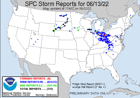
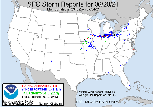
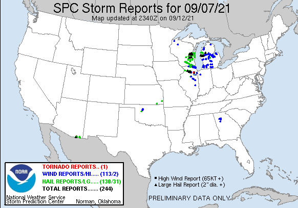
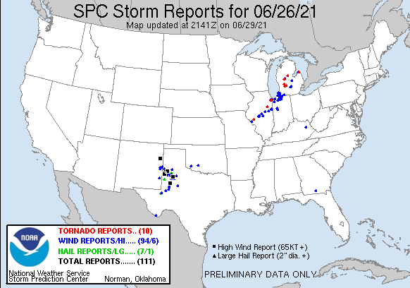
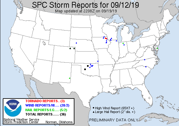
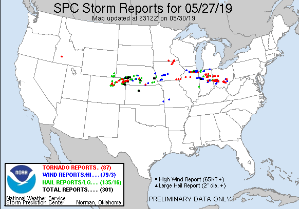
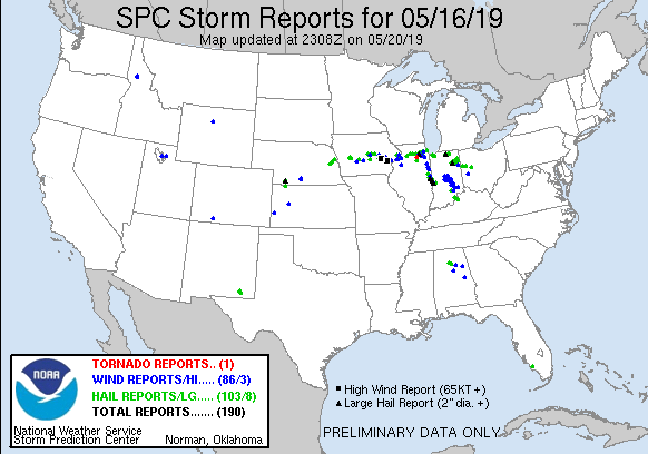
| Chase Statistics: Tornadoes: 0 Wind: 55-60MPH Hail: 0.50" (Marble Size) | SPC Severe Weather Reports: 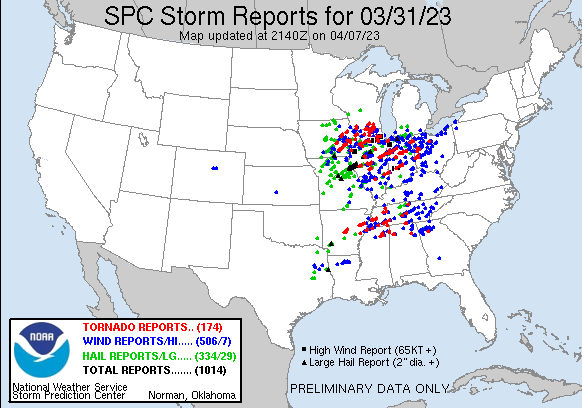 |
 RSS Feed