This was the second chase on the season.
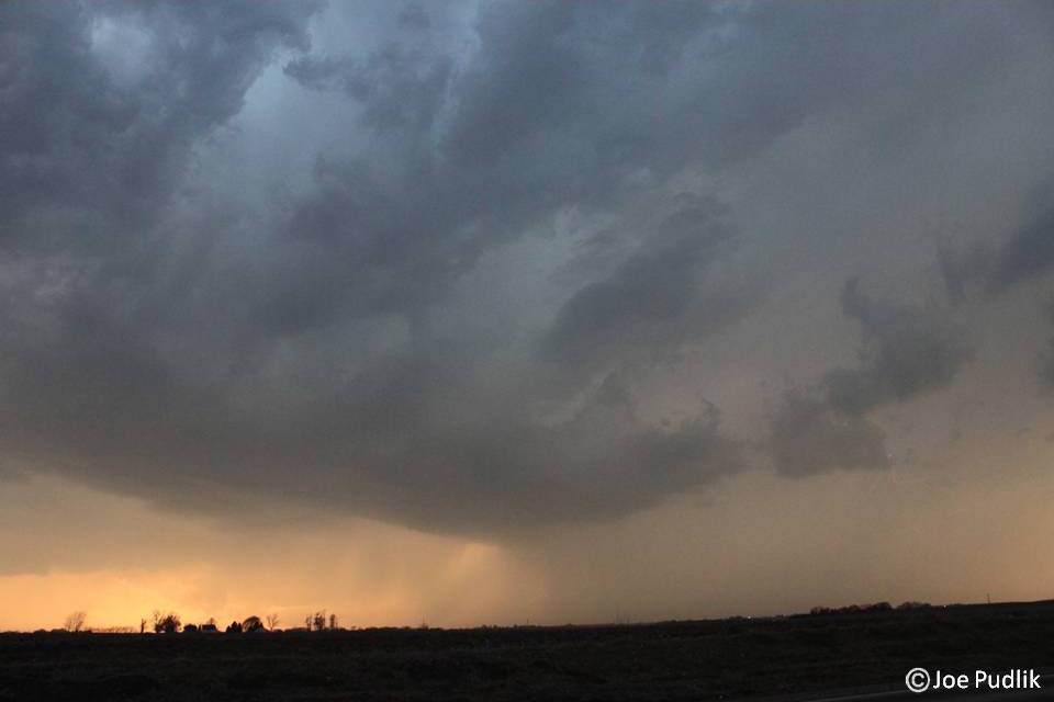
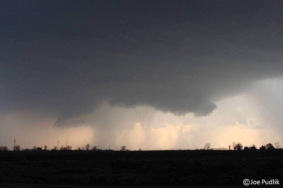
I made it to a rough target of Muscatine, IA by mid-afternoon. After looking over some data, I decided to head east. Storms quickly developed in East-Central Iowa after I was on the move. I ended up heading northwest to make a play on what was the northern supercell at the time. I ended up sitting on the north side of Tipton, IA watching the cell as it pushed eastward. It had interesting structure at times, but didn't have enough to produce.
After this I decided to head southeast into NW. Illinois to position myself ahead of the southern cells/line. I ended up sitting in Geneseo, IL along I-80 as the storm moved it. The storm featured winds of 40-50mph and hail up to penny size. I then jumped back on I-80 headed east where I encountered hail up to nickel size for most of the 50 mile drive from Geneseo to Ladd, IL. Blinding rainfall made it impossible to see any farther than the front end of your car over most of that drive too.
Some pictures and video from this chase can be viewed below. Additional pictures can be found in the 2011 photography section and additional videos can be found in the 2011 video section.
| Chase Statistics: Tornadoes: 0 Wind: 40-50MPH Hail: 0.88" (Nickle Size) | SPC Severe Weather Reports: 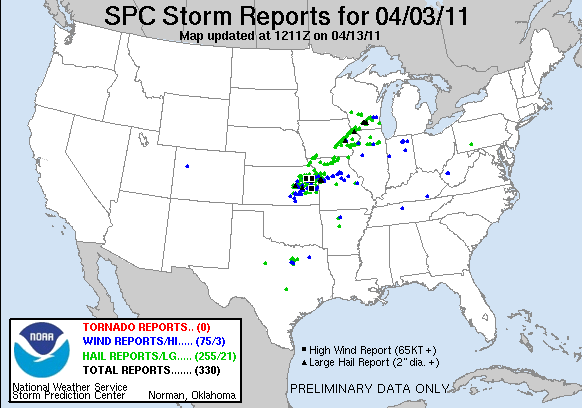 |

 RSS Feed