This day had shown potential to be a nice summer-like severe weather day several days out. I never had any thought of chasing, as it looked like the main threats would be wind and hail from an MCS and line segments.
I was at Six Flags in Gurnee, IL during the late afternoon and evening with my girlfriend. After going on some rides and having some funnel cake we decided to leave and head over the Baskin Robbins down the street for some ice cream. While leaving and heading over there a storm had quickly developed to our east, and became severe as it approached.
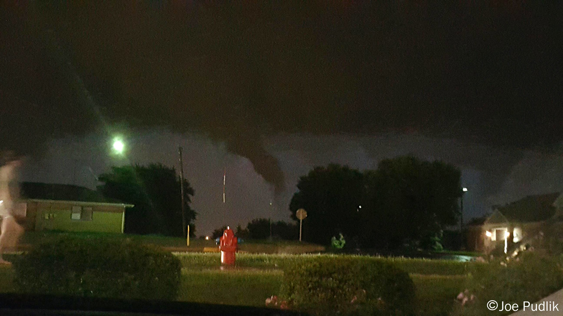
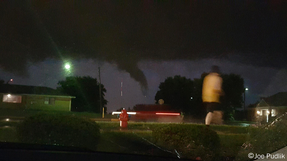
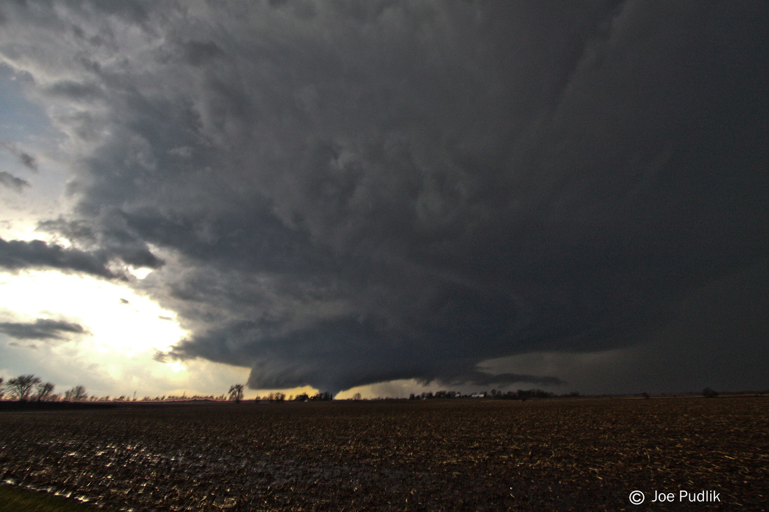
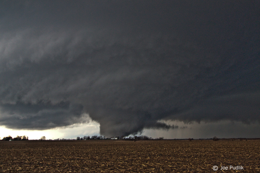
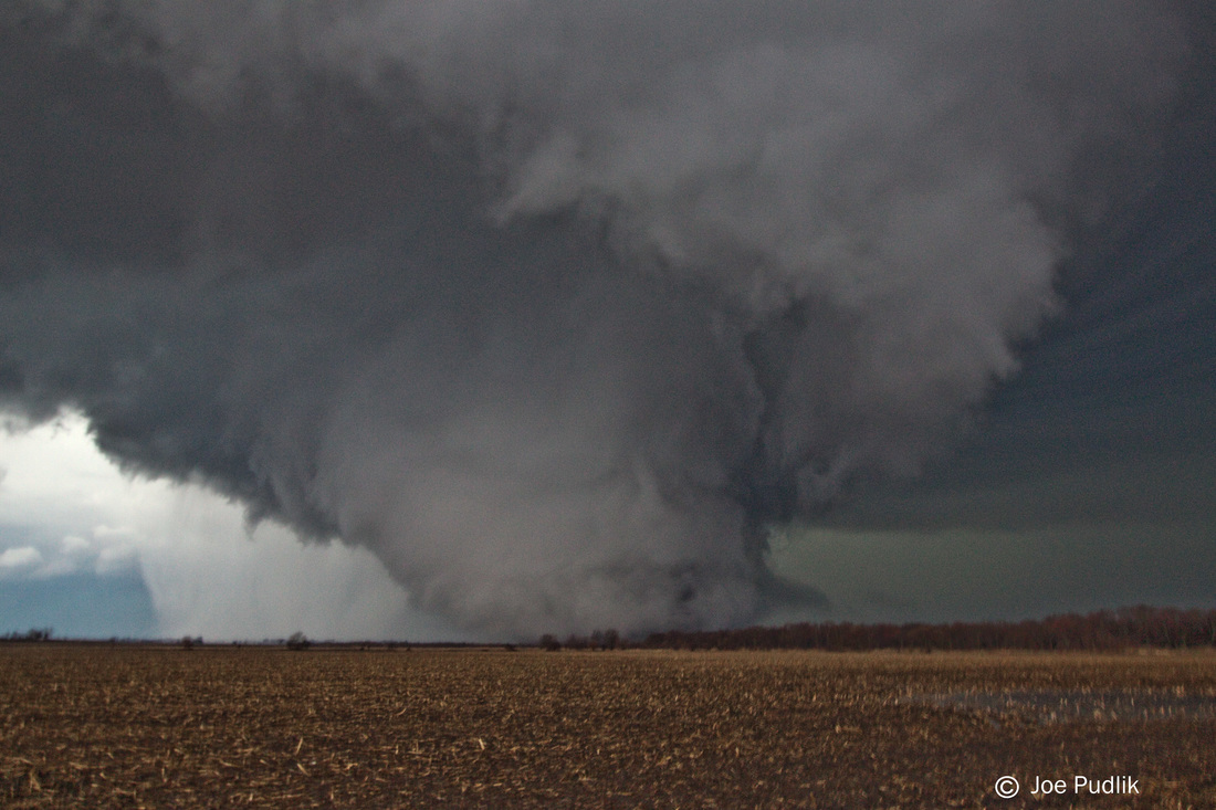
The storm started to hit while we were at Baskin Robbins, so we grabbed our ice cream and headed outside to watch it. It wasn't that interesting at first, and I threw out a comment that it could be better. It did get better, and quickly... Things picked up and we encountered hail up to penny size and winds gusts up to around 40mph. The wind, rain and hail combo put us on the mad dash to my car. Just after getting to in the car a tornado warning was issued for the storm, and looking at radar it was very likely a tornado was on the ground a few miles to our southwest. I decided to stay put and not move our position given the area of rotation was set to pass within our view looking south and southwest, and the road options in the immediate area were not great. Within a few minutes, a lowering came into view to our southwest. I was blocked by a building, so we could not tell if anything was on the ground, even though radar suggested it was likely. The area of interest continued to push into better view, where we saw it was indeed a tornado on the ground. It continued east into better view, as it started to weaken and lift.
Some pictures from this chase can be viewed below. Additional pictures can be found in the 2015 photography section.
I was at Six Flags in Gurnee, IL during the late afternoon and evening with my girlfriend. After going on some rides and having some funnel cake we decided to leave and head over the Baskin Robbins down the street for some ice cream. While leaving and heading over there a storm had quickly developed to our east, and became severe as it approached.
The storm started to hit while we were at Baskin Robbins, so we grabbed our ice cream and headed outside to watch it. It wasn't that interesting at first, and I threw out a comment that it could be better. It did get better, and quickly... Things picked up and we encountered hail up to penny size and winds gusts up to around 40mph. The wind, rain and hail combo put us on the mad dash to my car. Just after getting to in the car a tornado warning was issued for the storm, and looking at radar it was very likely a tornado was on the ground a few miles to our southwest. I decided to stay put and not move our position given the area of rotation was set to pass within our view looking south and southwest, and the road options in the immediate area were not great. Within a few minutes, a lowering came into view to our southwest. I was blocked by a building, so we could not tell if anything was on the ground, even though radar suggested it was likely. The area of interest continued to push into better view, where we saw it was indeed a tornado on the ground. It continued east into better view, as it started to weaken and lift.
Some pictures from this chase can be viewed below. Additional pictures can be found in the 2015 photography section.
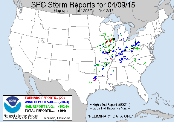
| Chase Statistics: Tornadoes: 1 Wind: 40-50MPH Hail: 0.75" (Penny Size) | SPC Severe Weather Reports: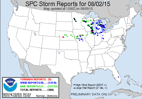 |

 RSS Feed