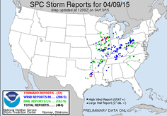
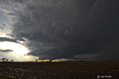
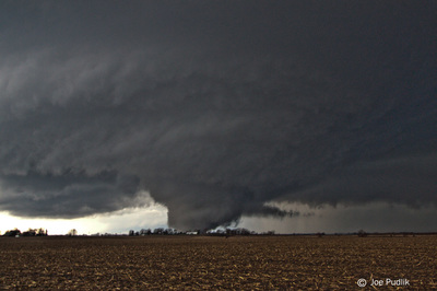
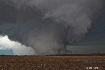
This day showed potential several days out. There was several concerns including how early day convection would evolve, how much destabilization would occur in the wake of this activity, and direction of lower level winds. All of these potential issues did not have any mitigating effects in the end.
Like usual on local chases I was slow/pessimistic to leave, and didn't get out to door until about 1:45. I had my brother tag along, and we had an initial target of Dixon, given the warm front was in the area and there was and OFB just to the north. We made it to Dixon as an initial storm was moving in. It featured a nice base/lowering for a time, but weakened as it pushed northeast. After it passed we waited in Dixon for quite a while to see how things would play out. New storms developed to our southwest and started to look interesting. We ended up heading through Dixon to make a play on one of the storms, which was now just to our west. This storm went on to be the Rockford tornadic storm. We got a view on it and a nice base/lowering while on the northwest side of Dixon. We continued to follow it north towards White Pines State Park, and then east through Oregon. As we made it east of Oregon we witnessed two brief touchdowns to our north, as the storm was near RFD airport and New Milford at the time. We continued to stair-step northeast with the storm, before finally dropping off of it as we sat south of I-90 and it continued northeast through Boone and McHenry counties.
At this time we headed back south to make a play on the what would become the Rochelle storm. After heading south for just a few miles on Irene Rd we got view of the tornado to our southwest. We pulled off to the side just north of Route 72, as we were in perfect position. We had a good view of the tornado for a decent amount of time, and were within about a 1/2 mile at the nearest point. This tornado probably featured the second best motion I've seen, only behind the Moore '13 and ahead of the Wayne 13' tornadoes. It featured multiple vortices, suction vortices, a horizontal vortex aloft and a satellite tornado that ended up touching down in the field next to us about 1/4 mile away. We continued to jog north/east and stayed with the storm and witnessed what appeared to be two other brief tornadoes to our north (Would have been southwest of Garden Prairie) while on Glidden Rd. NWS Chicago has since confirmed these two brief touchdowns were actually the end of one single tornado that had developed further to the southwest while we were driving.
Unfortunately, this fool left his camcorder on all day so the battery was dead by the time tors started happening, so I didn't get any quality video.
Some pictures and video from this chase can be viewed below. Additional pictures can be found in the 2015 photography section.


 RSS Feed