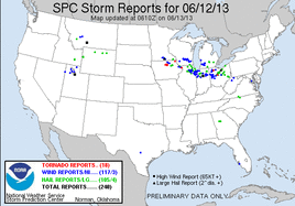
Going into the chase for this day the models had shown some risk for several days in advance, but the threat really didn't start to look chase worthy until a day or two before. What was a moderate risk ended up being upgraded to a high risk the morning of the 12th.
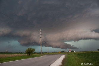
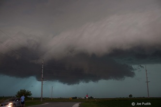
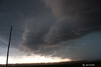
Given this was going to be a local chase I decided this would be a good opportunity to take my grandfather out on his first chase. We left just after 2PM with an initial target just west of Oregon, IL. While making the drive development started to occur to our west. We ended up making it to Oregon around 3:30PM as some of the initial storms started to become severe. There was a warned storm just to our south near Paw Paw and another up north near Rockford. I quickly decided to head back east to make a play one of the storms. After trying to decided if I wanted to make a play on the northern or southern cells, both of which were now tornado warned, I decided to head to southern one as it was closer and would have more time to interact with the boundary in the area without being disrupted. We ended up making it down and decided to sit northwest of Sandwich, where we had a nice view of the storm. We encountered a ragged lowering, which had some inflow, along with rising motion, some rotation and a gustnado. Continuing to follow the cell east, we allowed the cell/line to catch-up as we entered Plano. We stayed within the line along Route 34 from Plano to Oswego...Along the way we encountered winds around 60MPH and hail up to around quarter size. After this point I decided to call it a chase and head home.
Some pictures and video from this chase can be viewed below.


 RSS Feed