This day was part of a multi-day period of severe t'storm potential across the region, but didn't show as being chase worthy until the day or so before. The main question heading into the day was placement of a frontal boundary, timing of multiple disturbances moving through, and potential cloud/precipitation debris from the previous night.
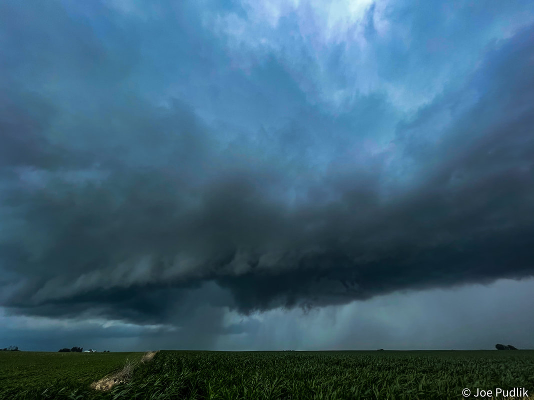
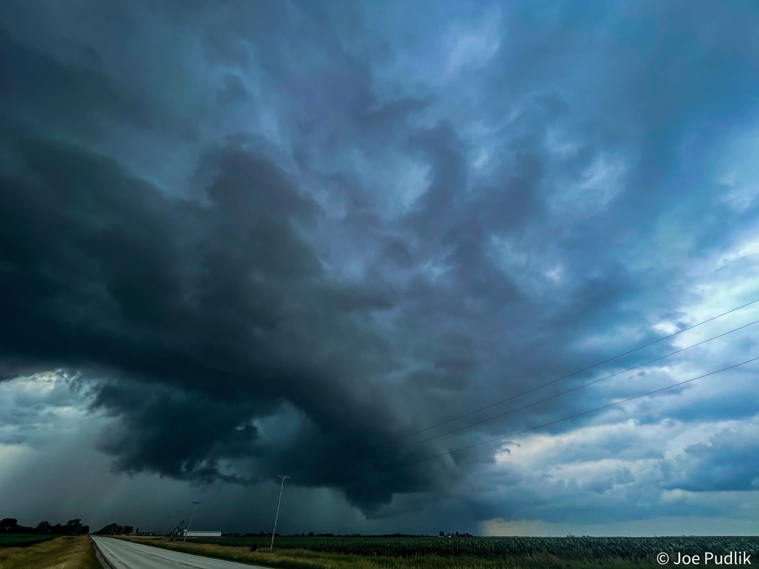
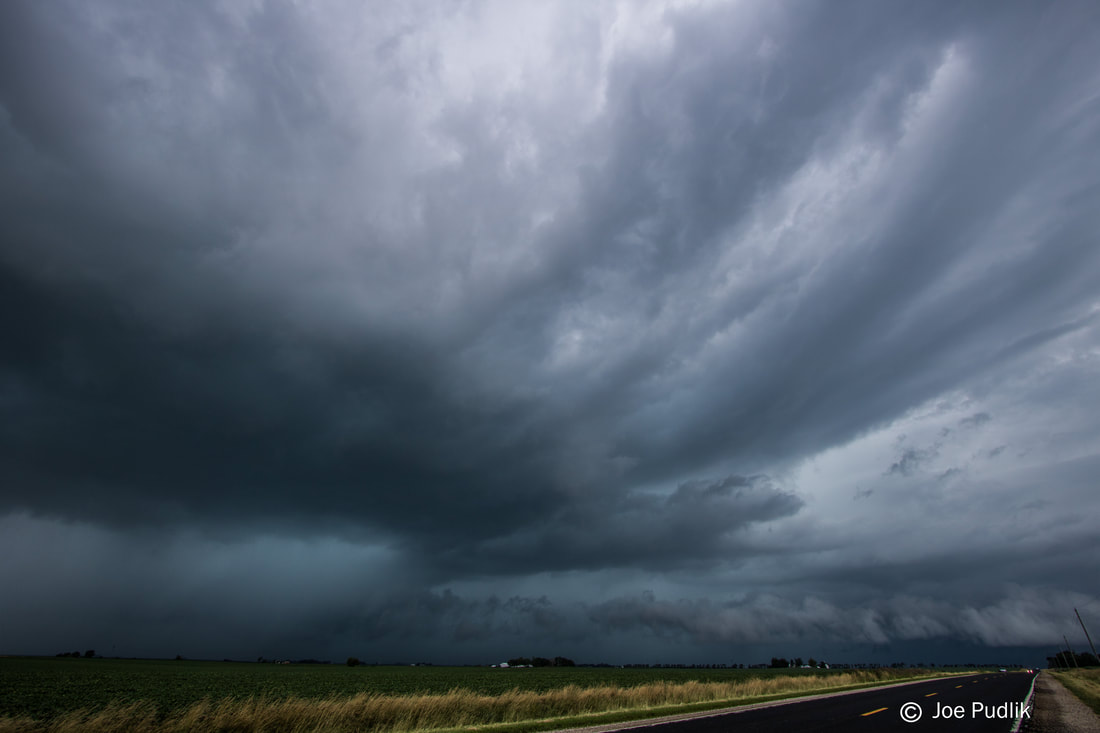
My girlfriend and I departed home around 11AM, with an initial target of near Lincoln, IL. Shortly after leaving, some initial t'storm development occurred along our path of travel on I-55, across portions of Northeast and Eastern Illinois. Some of this activity became severe t'storm and tornado warned, showing a bit of rotation. We intercepted our first tornado warned t'storm near Gardner. This t'storm was organized at first with a slight lowering, but then quickly weakened as it pushed east (Though it would eventually re-strengthen and organize once again to the east). After leaving the first t'storm, we dropped south on Route 47 and intercepted a pair of t'storms near Forrest. The lead storm had a brief funnel cloud before moving out of view, while the second t'storm developed a small wall cloud/lowering, before we decided to drop off of the t'storm. By this point the main focus was turning towards an area of t'storms that had developed across Central and Southwestern Illinois, with it pushing northeastward towards much of Central Illinois. We ended up heading west from Gibson City, eventually making it to south of Bloomington, with the now broken line of mini-supercells to our southwest to northwest. It was decision time, with three of the mini-supercells within reach, one northwest, one west and one southwest. We decided to head south on US 51 for a bit to get into position on the southern t'storm. Stopping in Clinton for gas, we decided to change direction and head back north on US 51, to make a play on the northern mini-supercell, which was tornado warned and showing decent signs of rotation. This decision made sense given it was a short drive to the northern storm, and we would be in position to drop south to any other t'storms if needed. After a short 25 minute drive north we intercepted the northern tornado warned t'storm, just north of Bloomington. This t'storm had a few lowerings as we attempted to follow it to the east-northeast, before it weakened slightly (Eventually re-strengthened to the east-northeast) and we decided to end following that t'storm near Lexington, which is where we then started to drop south towards the next t'storm. Heading south past the west side of Bloomington, we intercepted the next tornado warned t'storm near Downs. This t'storm also had a brief lowering, but was high-precipitation and thus hard to get a good visual. After letting this t'storm pass to the north, we decided to drop southeast to Farmers City get into position for the next tornado warned t'storm that was between Lincoln and Clinton at the time. After making it to Farmers City, it was evident that the incoming t'storm was outflow dominant and did not pose a significant threat. By this time it was later int he afternoon, and most of the main activity had already pushed to the northeast, so we called it a chase for the day and headed home.
Almost all of the t'storms were rotating across Central/Eastern/Northeast Illinois on this day, however only two brief and weak tornadoes occurred. Higher lapse rates, more southerly winds (Instead of SW/SSW) and less t'storm coverage would have potentially made this day much more significant tornado wise.
Some pictures from this chase can be viewed below.
| Chase Statistics: Tornadoes: 0 Wind: 40-50MPH Hail: None | SPC Severe Weather Reports: 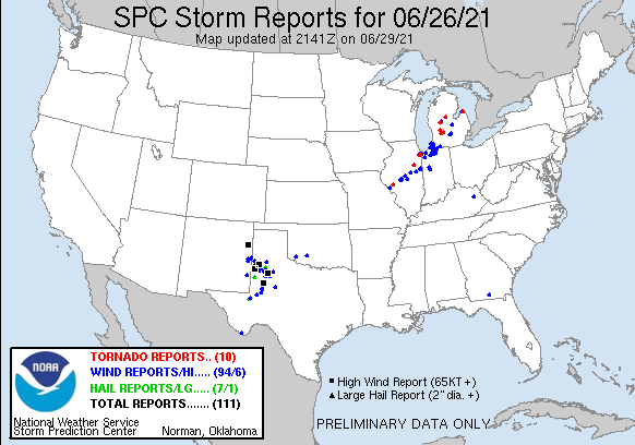 |
 RSS Feed