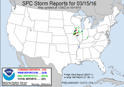
This day showed potential to be the first chase day of the season several days out. Leading up to the event the main question in the end was available moisture, and how high dew points would get, which would dictate the tornado potential.
We left home late morning, with a target area in far Western Illinois, likely in the Keokuk to Hannibal corridor. We made it out to Jerseyville, IL by mid afternoon, we we decided to sit and wait for initiation to occur further south, and initiation had already occurred further north. Some time passed, and there were finally some attempts at initiation just to our southwest. Unfortunately the first few attempts failed, before things finally took off and two supercells formed.
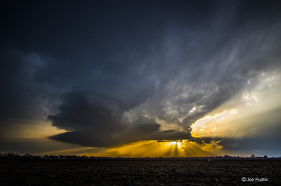
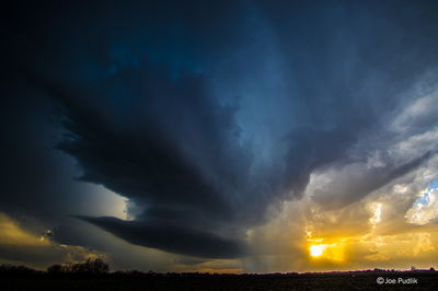
We had a nice view of the northern supercell, which slowly matured. I featured a nice structure, which included a nicely sculpted meso, and produced some marble (0.50") hail at our location. This storm showed some broad and weak rotation, but never could do more than that. During this time, the supercell to the south was also maturing, and was looking a bit better. We ended up heading east on I-72 to make a play on the southern storm. While heading east the southern supercell gained some weak rotation and became tornado warned, while the northern supercell started to fade as the southern one became more dominant.
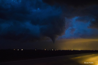
Continuing east on I-72 to New Berlin, and then south on a side road, we got view of the storm continued to have wall clouds and funnel clouds from time to time. While heading ENE on Old Route 54 to the southwest of Curran, rotation quickly tightened up, and a tornado touched down. The tornado was never fully condensed, with the visible funnel only halfway to the ground, but a bowl of dirt/debris was visible on the ground under the funnel. The tornado persisted several minutes as it pushed northeast towards Springfield, but luckily it lifted before moving into town and more populated areas. This tornado was rated an EF-1 by NWS ILX.
We continued to followed this supercell storm northeast for several more hours, as it continued to have a wall cloud from time to time. We eventually dropped off of it near Kankakee, as it was overtaken by a line of severe storms.
Some pictures from this chase can be viewed below. Additional pictures can be found in the 2016 photography section.


 RSS Feed