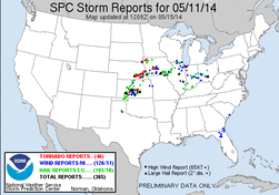
This day had shown potential for several days leading up to it, and as with the past several events, model guidance ended up coming around the the slower solution shown by the ECMWF model. The best potential for tornadoes looked to be from the triple point in S-C. Nebraska on eastward along the warm front into SE. Nebraska and Iowa. The question across this area is how would morning convection affect the main afternoon/evening potential. Severe storms looked likely farther south in Kansas along the dryline as well, but high LCL's due to the larger temperature/dew point spread would likely limit the overall tornado threat down that way.
Adam Lucio and myself left the Chicago area just before 7AM. Making fairly good time, we made it the the general target area in SE. Nebraska just before 3PM. Driving south out of Lincoln, NE on Route 77 a storm started to develop well to the west near Hastings, just north of the warm front. Seeing that there was nothing developing near us and the CU field was not looking that great, we decided to head west on Route 41 towards this storm.
While heading west the storm rapidly developed into a supercell, but it was still just north of the warm front. Shortly after this time a tornado was reported near Glenvil. As we came up on the storm it looked like a mess, with little in the way of structure to it. The radar presentation showed a nice looking supercell, with the hook and updraft located right near the warm front. At the same point we came up to it another tornado was reported near Clay Center, off to our west. While jumping around on a few roads during the first interaction with the storm we encountered a few gustnadoes, and an interesting feature that was sucking scud and dirt from the ground directly upward to the cloud base, but it wasn't rotating. We dubbed this feature the vacuum-nado. Also during this time while heading north on a side road, we witness the left edge/portion of what was the Clay Center/Sutton tornado.
Making it north to Grafton, we made the short jump east on Route 6 to Fairmont, then started heading north on Route 81, which is where we entered the bears cage. Just a few miles north of Fairmont to our west we witnessed another tornado, which was first seen by it's left edge, but then emerged out of the rain. Racing north this tornado passed to our south as we were blasted by inflow winds. We made it to McCool Junction where we headed east on Denton Rd. This is where we once again caught a glimpse of the tornado which had passed south of us while on Route 81. Continuing east on Denton Rd that tornado weakened to our south, but the occluding circulation was crossing the road several miles to our west. At this time we pulled off to the side just in time to see a rope tornado cross the road from southwest to northeast a few miles to our west. The rope quickly dissipated, but gave way to a brief cone-ish tornado which moved in the opposite direction of the previous rope tornado, from north to south, and in the same area. This occluded/weakening circulation then pushed southeast towards towards us, reaching the field in front of us just as we decided to head east. At the same time this was occurring, another tornado was developing just to our south-southwest near Cordova. This tornado quickly grew and passed the road just behind us as we headed east. We were once again blasted by inflow winds once again, which were likely 70-80MPH and snapped power poles along the road as we passed.
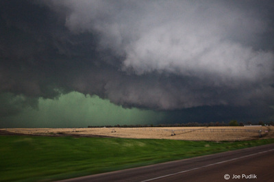
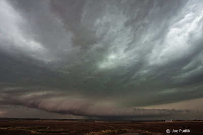
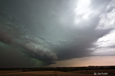
We continued east on Denton Rd until we reached Route 6, and then stair-stepped northeast ahead of the storm on Route 15 to Seward and then Route 34 and 79 up to Raymond. Being well ahead of the storm now we pulled off to take a few shots of the storm, which had decent structure now. Continuing southeast back towards Route 6 the supercell started to interact with other storms and the tornado thread started to trend downward. At this point we decided to call it a chase, head to Omaha for some dinner, then start the drive home. While in Omaha/Council Bluffs having dinner, what was now a line of severe storms hit bringing winds of around 60mph.
Some pictures and video from this chase can be seen below. Additional pictures can be found in the 2014 photography section.


 RSS Feed