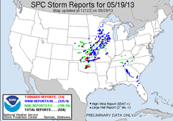
This was the second day of the three day Plains chase. We started off the day in Great Bend, KS where we had stayed the night before. We hit the road with a target area near the KS/OK border…Eventually choosing the
town of Medford, OK. We made it down to Medford, OK just after noon, where we only sat for a short time before
development started. The initial development occurred just over the KS/OK border, moving northeast. We decided not to go after this activity, which eventually went on the produce tornadoes put towards Wichita.
More development soon started to occur to our west, thus we decided to head west of town and set up on it. This activity was unorganized and slow to develop for quite a while as it pushed northeast. Eventually as activity crossed the KS/OK border and into far S. KS things became better organized. While driving on rural roads northeast of Caldwell, KS we witnessed a funnel cloud that appeared out of nowhere in front of us. There was a report of a tornado with this, but there has yet to be any confirmation.
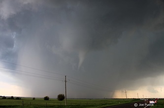
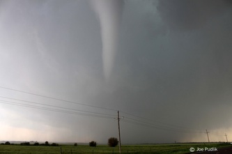
At this point storms had started to back build down into N. Oklahoma, with things becoming a bit more linear with embedded cell structures. We decided to jump south towards and interesting embedded structure moving towards South Haven, KS. After a short jump south we made it to the west side of South Haven just as the cell was moving in. There was an area of broad rotation, which quickly tightened up. Shortly thereafter a funnel cloud formed; follow by a needle/pencil tornado, which bounced around as it pushed east. The tornado lasted a few minutes as it passed through the field to our south, before lifting. We also had some nickle size hail. Heading back east to get out ahead of the area that was still showing rotation, we encountered very strong winds that were snapping tree branches around us.
Making it out ahead of the line, we sat on a rural road southeast of South Haven for a while watching the line of storms approach. A few storms at the tail end of the line in N. Oklahoma started to catch our eye, so we decided
to head down that way. At this point there were tornado storms occurring northwest of the OKC metro area. For a time there was some thought on whether or not we should attempt to jump south and make a play on them, but we decided not to given the uncertainty and unfavorable terrain they were moving into. Instead we dropped south and sat in a rural area northwest of Billings, OK, west of I-35. Watching the activity in this area for a while, most struggled, but eventually one cell became interesting enough to pursue as it pushed northeast. This cell showed some interesting structure at times and was tornado warned, but we struggled to keep up with it and eventually called the chase after following it to the KS/OK border, north of Ponca City, OK.
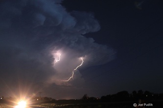
We ended up heading to Ponca City for dinner, where a few other chasers ended up meeting us. During dinner a new line of storms developed to our west and pushed east, eventually back building and training just to out south/east. At this point it was dark and we decided this would be a good opportunity to head just outside of town for a lightning photo op. We ended up with a great light show, as we viewed and snapped some photo’s from a few
locations outside of town. After things started to die down we headed back to
town where we stayed for the night.
This chase day also provided another first for me…It was the first time I’ve had back-to-back days and chases with
tornadoes.
Some pictures and video from this chase can be viewed below. Additional pictures can be found in the 2013 photography section.


 RSS Feed