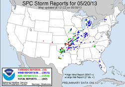
This was the third and final day of the three day Plains chase. We started off the day in Ponca City, OK where we had started the night before. Heading out during the morning we had an early target area around and south of the Oklahoma City area, more likely just south to stay away from the metro area. We made it down to Norman just after noon, where we stopped and met up with a few chasers. After sitting in Norman for a short time development started to rapidly occur to our southwest, with numerous discrete cells popping up.
We decided to make the short drive southwest to make a play on a cell that was set to pass just northwest of Purcell, OK. On the way down to this cell another storm quickly began to develop and take on supercell characteristics to our northwest, west of the OKC/Moore/Norman metro area. As we continue to advance southwest to make a play on the Purcell storm, the rapidly strengthening storm to our north started to show rotation and ended up being tornado warned. We quickly made the decision to head north to make a play on it.
While making the drive north I was following what was going on with the northern storm, and watched as the tornado initially touched down west of New Castle. Shortly after this we made it into the town of Newcastle, where
we were going to head north to get ahead of the storm, and let it follow just behind us, which would give us a good view. That plan was quickly scrapped as police blocked off the interstate, thus we were forced to take rural roads to
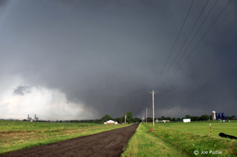
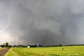
the east of Newcastle…The only problem with this was the Canadian River ran just to the east, and there were no river crossing other than the blocked interstate or a highway well to our south. Thus we decided to just take the rural roads and view what we could. While making our way northward on the rural roads east of Newcastle to tornado came into view, large and violent. We came to a stop just about as far north as we could, and watch what was now a violent EF-4 tornado move from our northwest to north. Pushing across the area in front of us, you
can see the strong outer winds of the tornado, showing up as a haze-like appearance near the surface and wrapping into the tornado. There was also the roar…It’s not like a freight train as many say, it’s more like the mixture of a
jet engine and a growl. That sound is something I’ll never forget. Still in view, the tornado continued to move east, now pushing to our northeast. By this point the tornado was becoming rain wrapped from our view, just as it was moving into Moore, where it was its strongest…an EF-5. Wanting to keep up with the storm/tornado, we quickly dropped south to Route 9 and then started to weave our way northeast. We finally caught back up with the storm west Shawnee, OK, but by this time the storm appeared to have weakened a bit and was no longer producing
a tornado. We decided to drop off of this storm and head south to what was another tornado storm to our southwest.
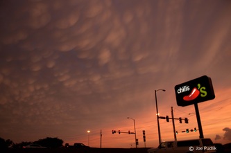
Making the quick drive south we made it to the next cell as it approached Stratford, OK. Upon arriving there was rotation and a funnel cloud, but it dissipated as the storm started to weaken. By this point it was evening and we decided to call it a chase. We ended up heading back north to Shawnee where we had dinner with a few other chasers and then stayed the night. We drove back to Chicago the following day.
This chase day also provided more firsts for me, though one unfortunate given the outcome…The Moore, OK tornado was the strongest tornado I’ve witnessed, rated an EF-5. This was also the 3rd chase/day in a row with a tornado, which was also a first. I’ll never forget the Moore tornado…The sound, the size, how violent it was and the unfortunate outcome.
Some pictures from this chase can be viewed below. Additional pictures can be found in the 2013 photography section.


 RSS Feed