This day looked like a potential severe t'storm/tornado outbreak-like day across the area, having similarity to other high end area events, such as 6/5/2010. There were very few concerns heading into this day overall.
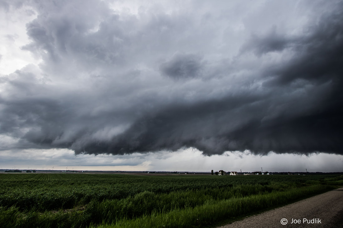
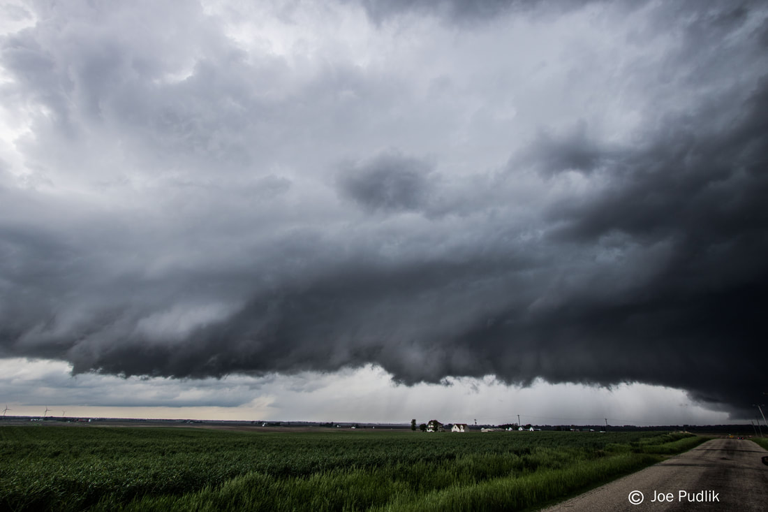
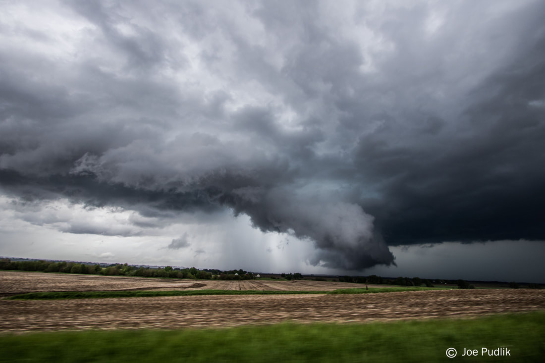
I ended up heading out just after noon, with a target of near or just south of I-80...Between I-74 and I-39. Ended up passing a first initial supercell that pushed across the south Chicago metro, just as it was starting to get going in the far SW suburbs. However, I decided to not chase it, given it was heading into the metro and could put me out of position for the main activity expected further west. On the drive down I was also watching the cluster of tornadic supercells pushing from Southeast Iowa into Western Illinois, but was not fond of how messy and clustered they were. Stuck with the original plan and I made it to Princeton IL, prior to 2PM. By this time a few supercells had developed near Moline IL, and were starting to slowly mature and push east. I grabbed some food really quick in Princeton, before heading after the better looking storm just as it went tor warned off the the northwest. I reached the storm as it was approaching Deere Grove IL. At this time, the storm was outflow dominant and fighting other storm development nearby. Continuing to stair-step east with this storm, to north and northeast of Walnut IL, the storm continued to be fairly outflow dominant, as it ingested another storm or two...However, there was one point that it did seem to make an effort to organize for a sort time, with even a more concentrated area of rotation/lowering. I continued east with this storm through the Sublette IL area, eventually reaching Route 251. Through this point the storm continued to be outflow dominant, and there was also widespread additional t'storm develop, which would hamper further potential with this storm. At this point I called it a chase and headed home.
It appears that a remnant MCS over Missouri, and possibly the early developed cluster of supercells that pushed across Southeast Iowa/Western Illinois, are possibly two factors in why the potential across Eastern Iowa and North-Central Illinois was not realized. However, a significant severe t'storm and tornado event did unfold further east, across Indiana and Ohio.
Some pictures from this chase can be viewed below. Additional pictures can be found in the 2019 photography section.
| Chase Statistics: Tornadoes: 0 Wind: None Hail: None | SPC Severe Weather Reports: 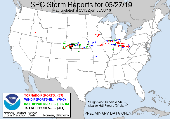 |
 RSS Feed