This is the second of two chase days in this period. There appeared to be two areas of potential, one across C. Kansas and the other across W-C. Oklahoma and N. Texas. Instability, moisture and shear looked favorable leading up to this day. However, capping and quantity of storms looking to be the biggest concerns once again.
I once again was chasing with Adam Lucio, Chelsea Burnett and Jonathan Williamson. We started the day in McPherson, KS. Upon waking up and looking over data, a main target within W-C. Oklahoma looked like the best bet. Further north across Kansas appeared as though would suffer from having too many storms and more linear activity, with better discrete activity likely being across Oklahoma. We set out in a caravan of two vehicles with an initial target of Seiling, OK.
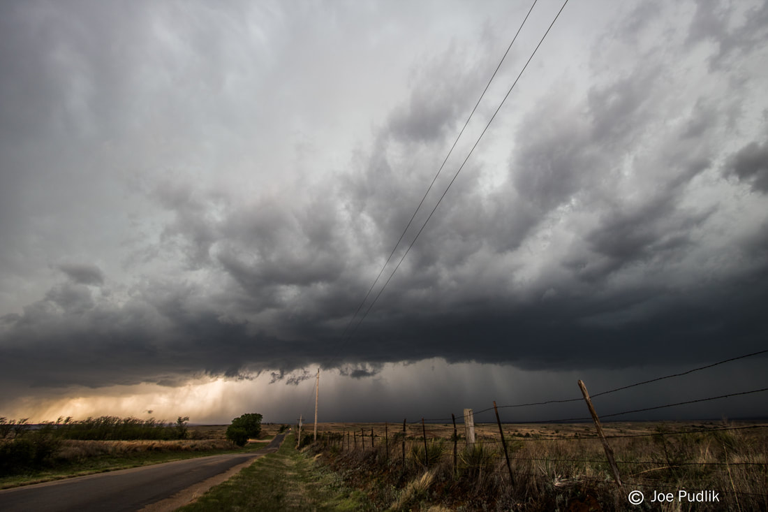
We made it down into NW. Oklahoma as initiation was already occurring and maturing across SW. Kansas and the Oklahoma Panhandle. This activity would eventually go on to be tornado and damaging wind producing storms in Kansas. As we continued south, additional development occurred in the E. Texas Panhandle, which slowly matured. We ended up getting on our first severe warned storm near Elk City, OK. We followed this storm ENE for a while, but it was high based and seemed to struggle, eventually weakening. By this time further development occurred to our south and became tornado warned supercells. We decided at this point to drop off of our original storm, and head down to this new activity.
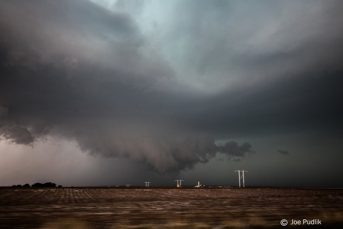
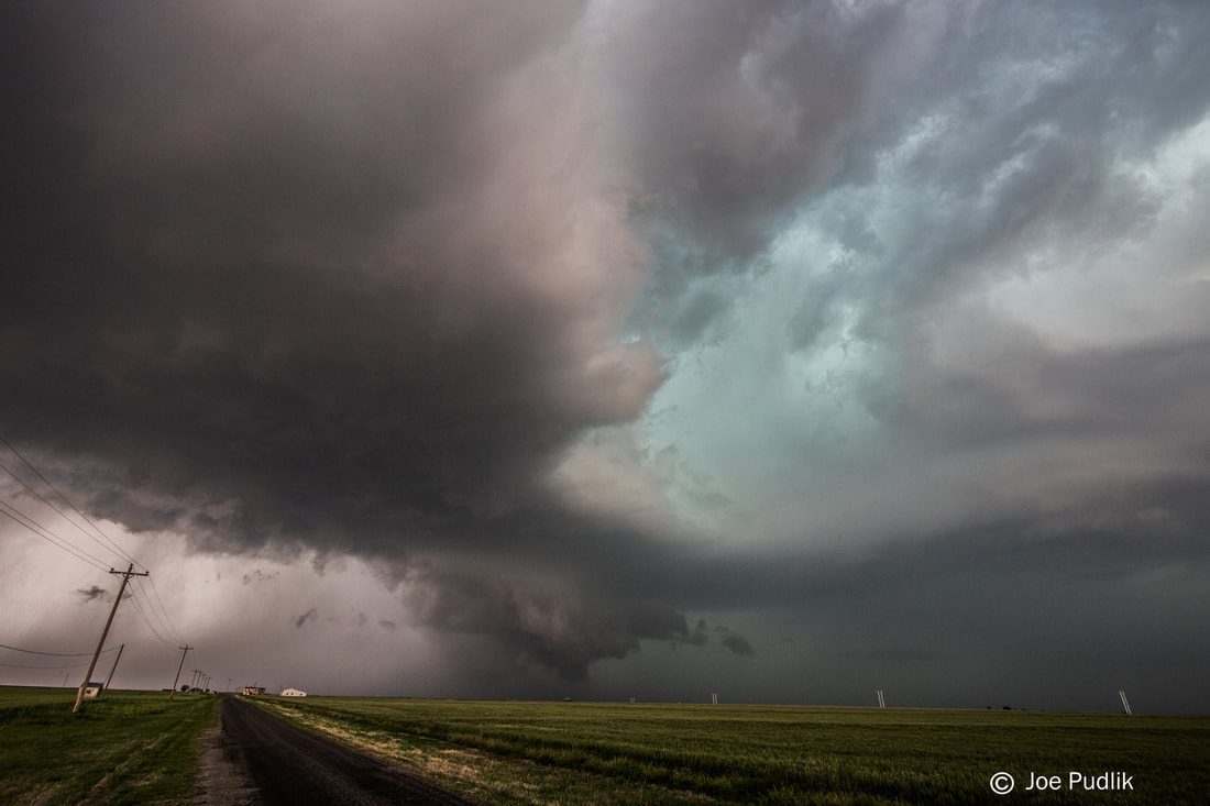
We made it to our new target storm as it approached Mountain View, OK. We ended up following this storm to the ENE, as it had lowerings and gustnadoes at times. However, it was struggling to maintain and produce, and was closing in on the OKC metro area as well. We decided to drop south off of this storm onto another tornado warned supercell that had recently developed to it's south. Upon arriving to this storm it was struggling as well, as all of the storms in the area started to interact and congeal into a large cluster. We ended up sitting on Highway 81 well north of Chickasha, OK for a while, watching this storm struggle, though it did have a lowering for a time. By this time a damaging wind producing bowing line segment was racing NE towards us, and showing a bit of rotation on the north side. We decided to call it a chase and head to Chickasha. Arriving in Chickasha a report came in of a tornado close to where we had been sitting a short time before on Highway 81, associated with that aforementioned rotation with the bowing line segment.
Some pictures from this chase can be viewed below. Additional pictures can be found in the 2018 photography section.
I once again was chasing with Adam Lucio, Chelsea Burnett and Jonathan Williamson. We started the day in McPherson, KS. Upon waking up and looking over data, a main target within W-C. Oklahoma looked like the best bet. Further north across Kansas appeared as though would suffer from having too many storms and more linear activity, with better discrete activity likely being across Oklahoma. We set out in a caravan of two vehicles with an initial target of Seiling, OK.
We made it down into NW. Oklahoma as initiation was already occurring and maturing across SW. Kansas and the Oklahoma Panhandle. This activity would eventually go on to be tornado and damaging wind producing storms in Kansas. As we continued south, additional development occurred in the E. Texas Panhandle, which slowly matured. We ended up getting on our first severe warned storm near Elk City, OK. We followed this storm ENE for a while, but it was high based and seemed to struggle, eventually weakening. By this time further development occurred to our south and became tornado warned supercells. We decided at this point to drop off of our original storm, and head down to this new activity.
We made it to our new target storm as it approached Mountain View, OK. We ended up following this storm to the ENE, as it had lowerings and gustnadoes at times. However, it was struggling to maintain and produce, and was closing in on the OKC metro area as well. We decided to drop south off of this storm onto another tornado warned supercell that had recently developed to it's south. Upon arriving to this storm it was struggling as well, as all of the storms in the area started to interact and congeal into a large cluster. We ended up sitting on Highway 81 well north of Chickasha, OK for a while, watching this storm struggle, though it did have a lowering for a time. By this time a damaging wind producing bowing line segment was racing NE towards us, and showing a bit of rotation on the north side. We decided to call it a chase and head to Chickasha. Arriving in Chickasha a report came in of a tornado close to where we had been sitting a short time before on Highway 81, associated with that aforementioned rotation with the bowing line segment.
Some pictures from this chase can be viewed below. Additional pictures can be found in the 2018 photography section.
| Chase Statistics: Tornadoes: 0 Wind: 50-60MPH Hail: 0.25" (Pea Size) | SPC Severe Weather Reports: 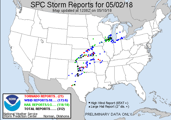 |
 RSS Feed