While this day had decent potential to be a quality severe t'storm in portions of the region, it was not one that I was planning to chase. I just so happened to be down in Central Illinois with my wife for a conference she was going to attend for work the next day. On our way down there during the afternoon, it was apparent that we may indeed have a surprise chase on our hands if activity came close enough to where we needed to be, which was Springfield, IL.
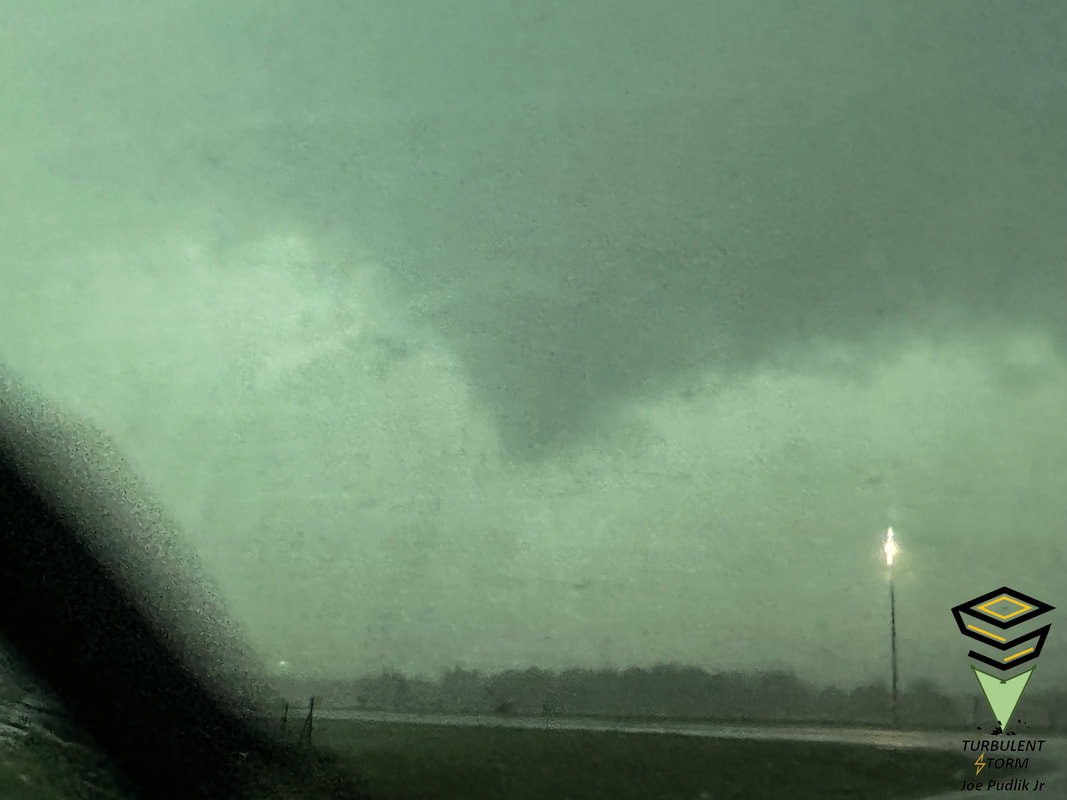
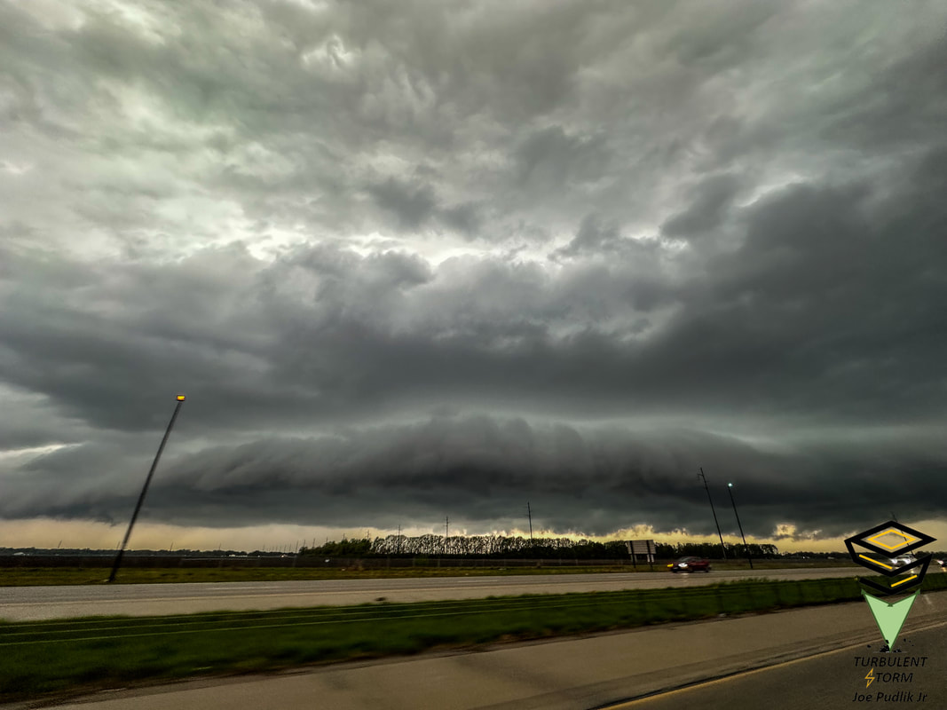
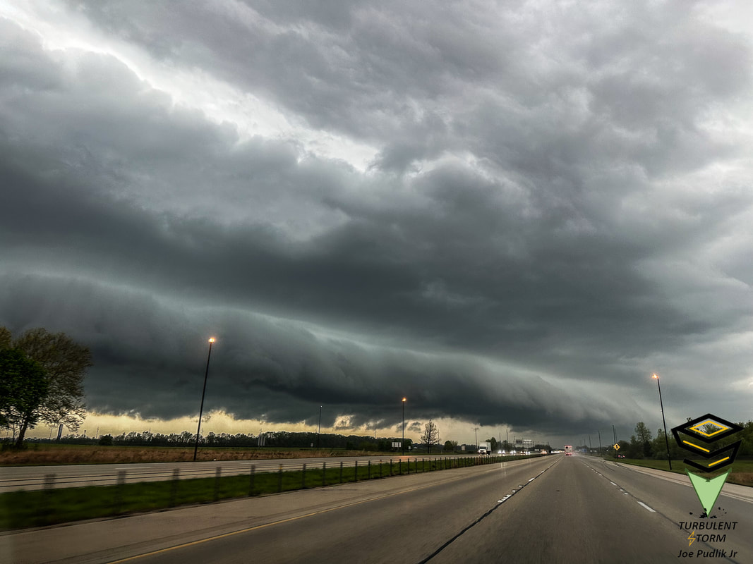
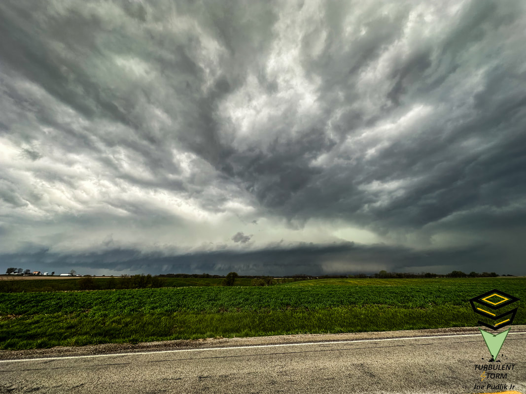
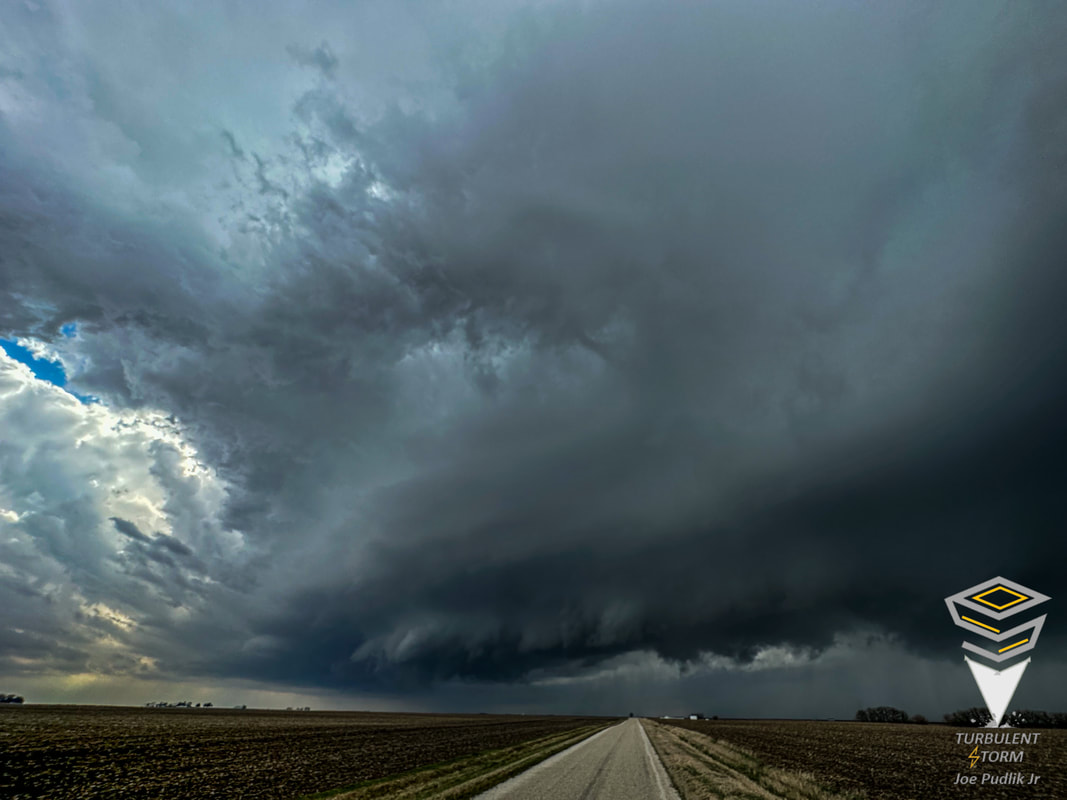
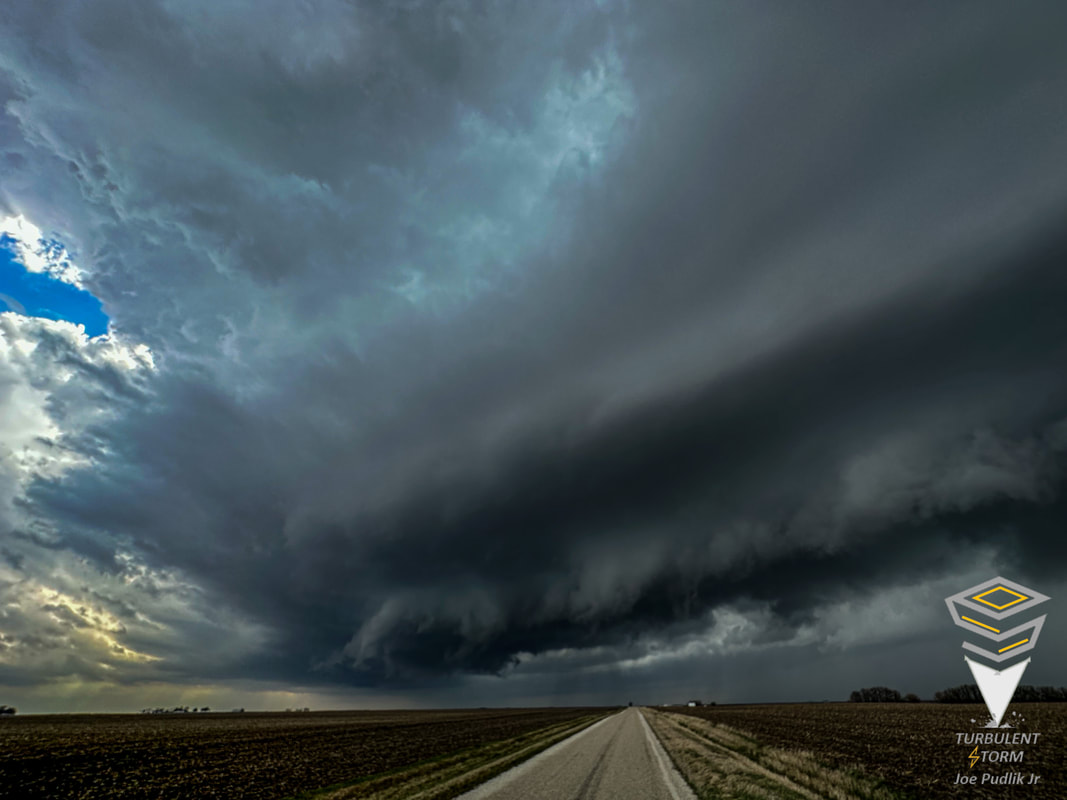
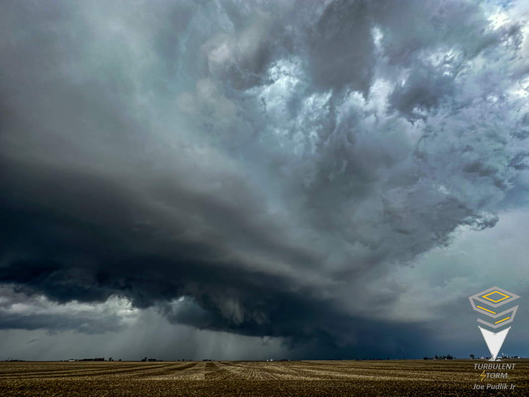
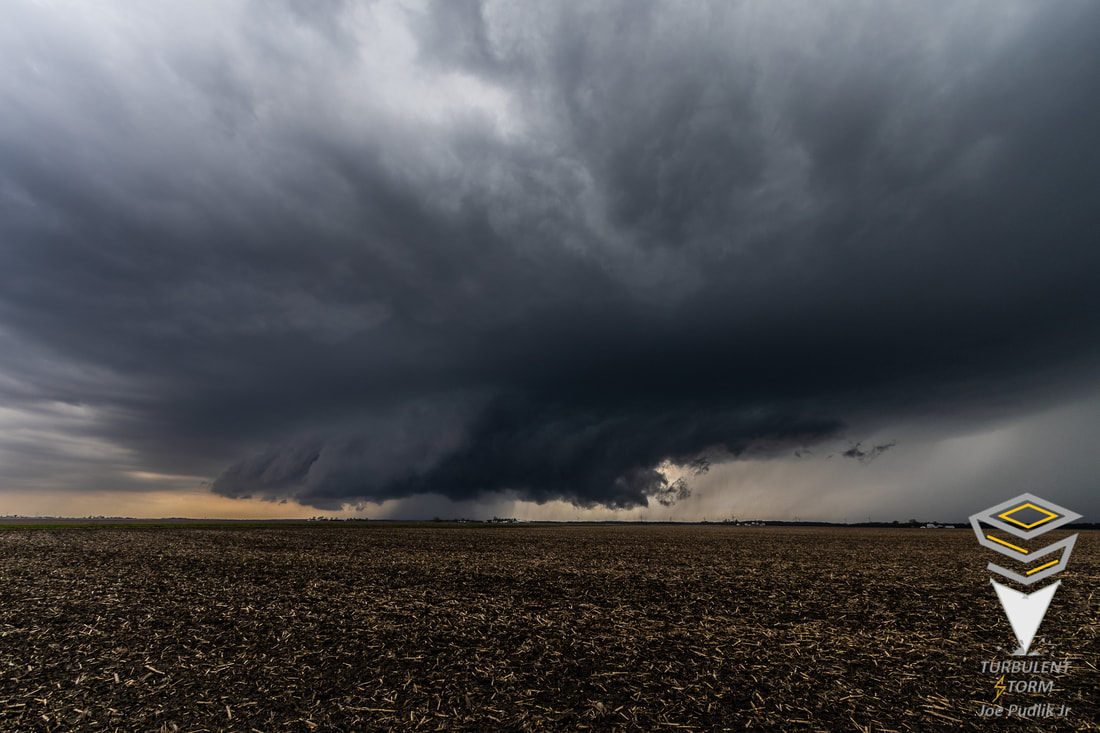
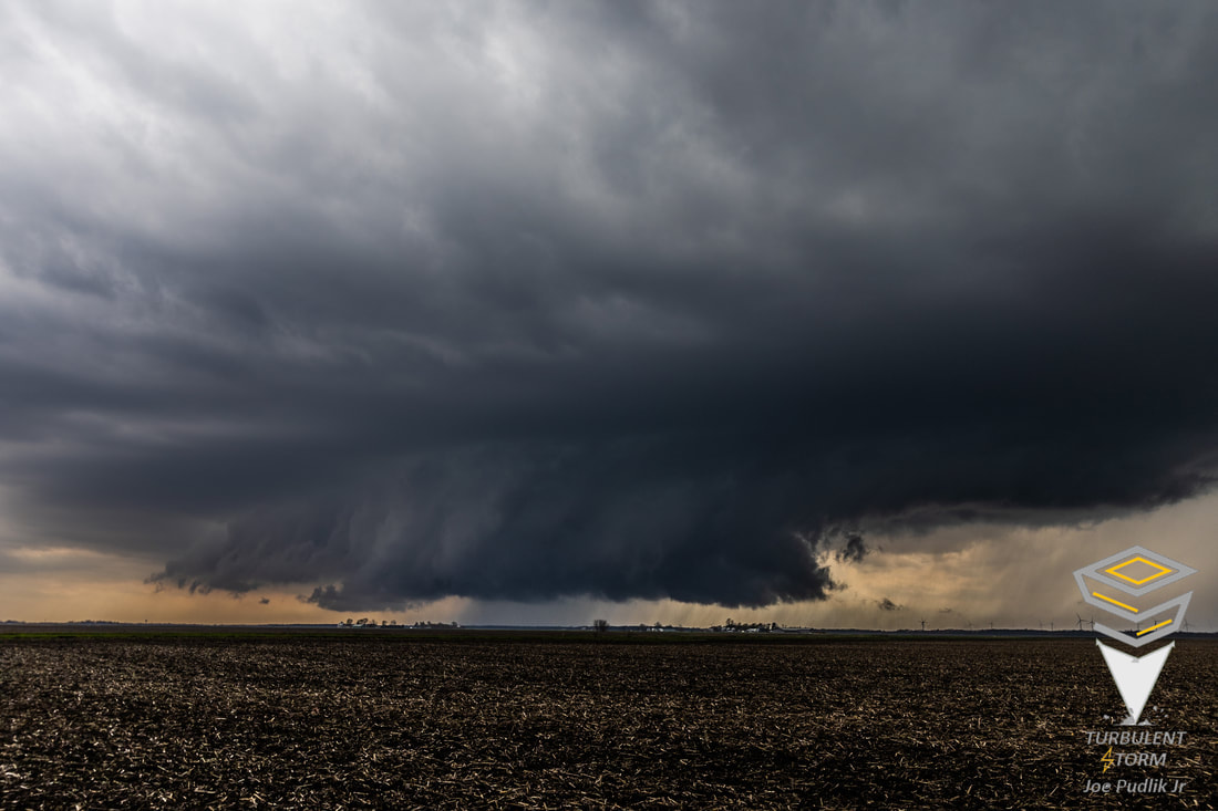
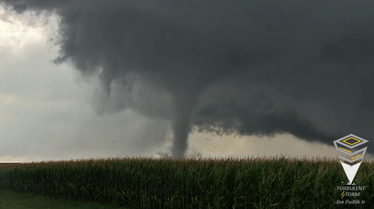
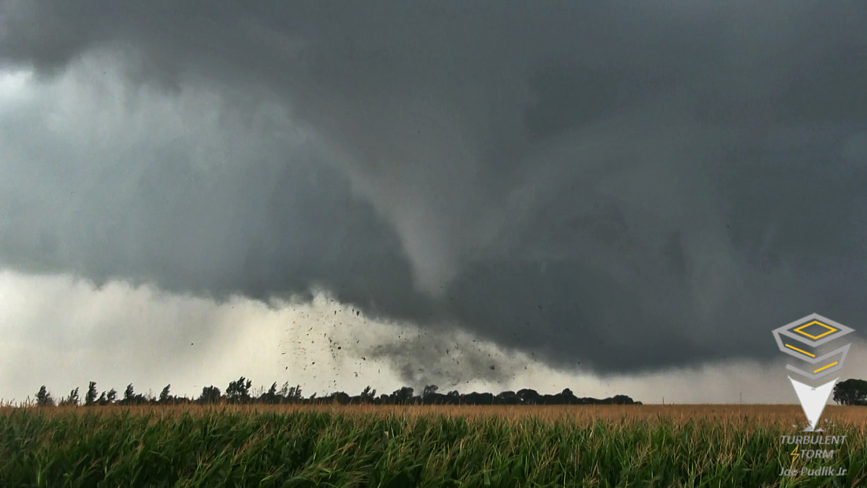
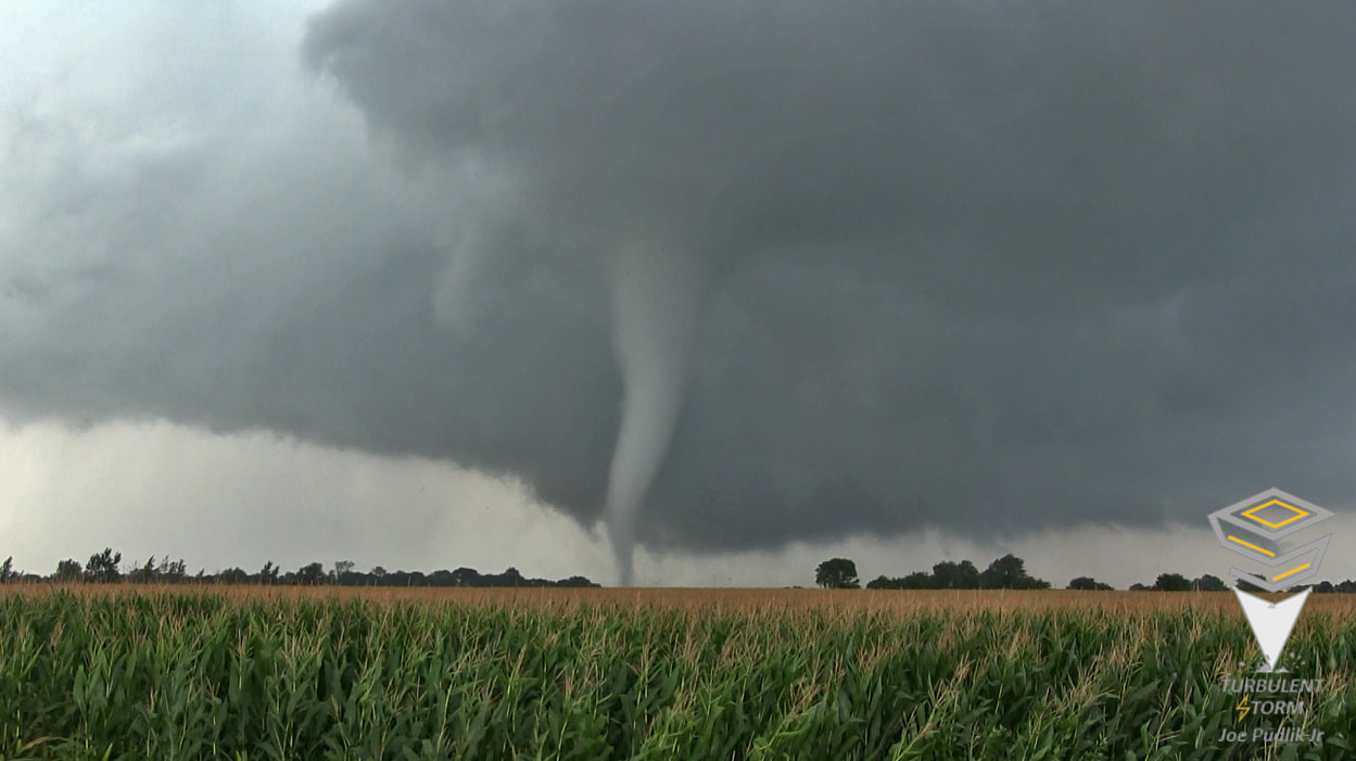
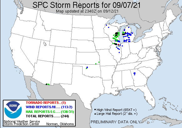
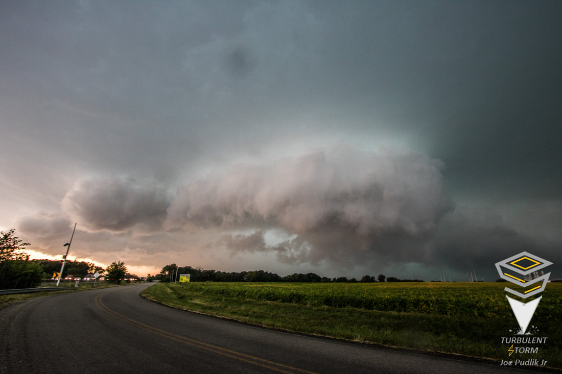
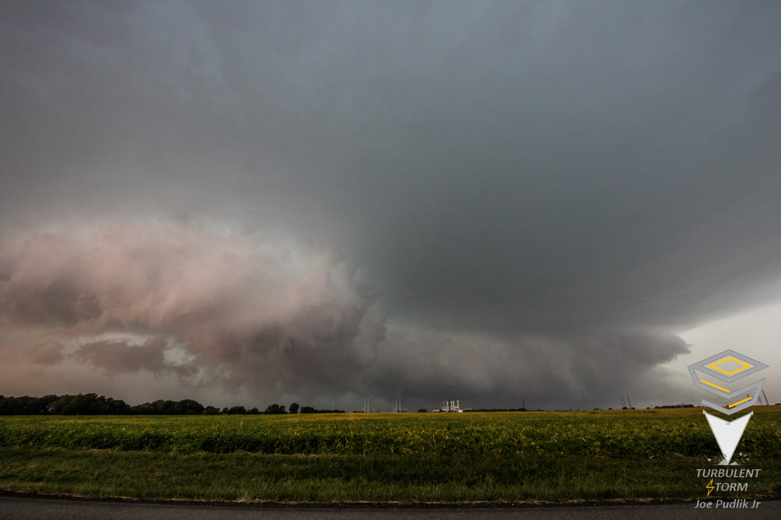
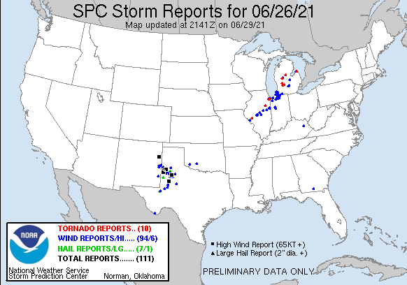
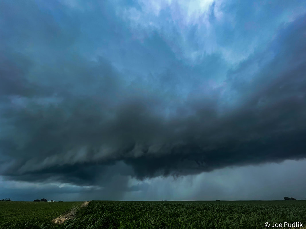
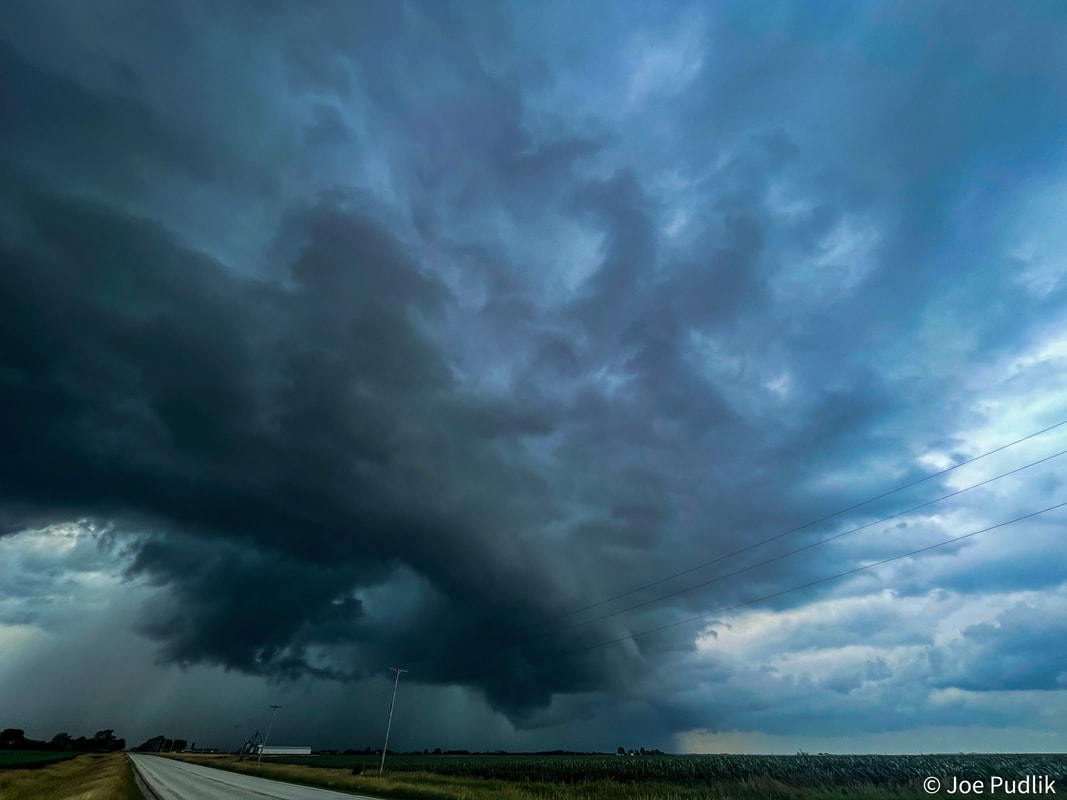
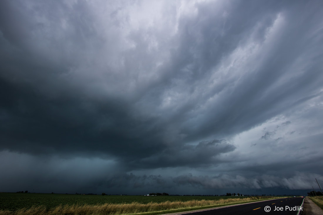
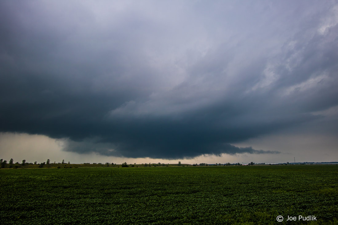
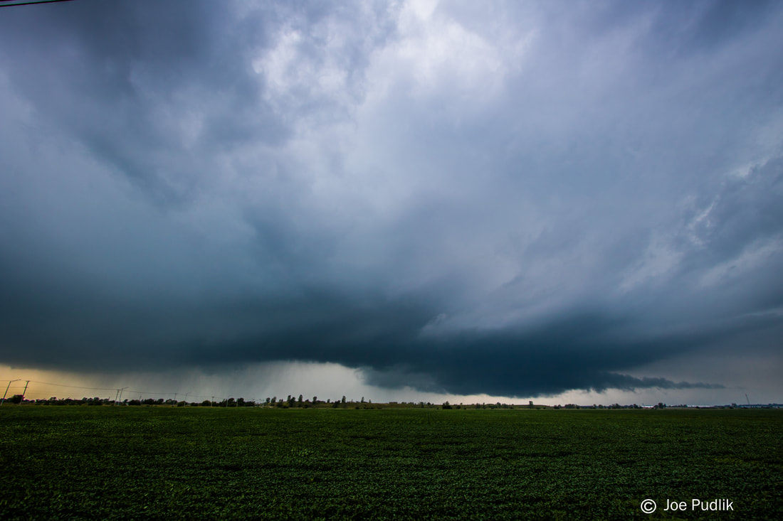
After leaving home and while driving downstate on I-55 during the afternoon, numerous severe t'storms developed across Eastern Missouri, many of which were supercell t'storms. As we approached Springfield, IL, the most northern supercell t'storm became tornadic as it tracked across rural areas of Western Illinois. It was very clear that this tornadic supercell t'storm was indeed going to pass close enough to Springfield, IL, that we would have a small window of opportunity to chase it before needing to be back in Springfield, IL, for mid-evening plans. Continuing southward on I-55 and exiting at Farmersville, IL, we got a view of the tornadic supercell t'storm. We continued a bit more south, making it to just west of Waggoner, IL, where we sat and watched things for a bit. After several attempts, a solid wall cloud developed along with a funnel cloud, which made it approximately halfway to the ground. Given our distance, which was several miles away, it was hard to tell if there was any touchdown or not. The wall cloud and funnel cloud diminished after a few minutes, at which point I decided to reposition us a bit further south and east, on the east side of I-55. Following the still tornado warned supercell t'storm further southeast, the storm was still showing weak rotation at times, both visually and on radar. We made it to near Raymond, IL, to sit and watch the tornado warned supercell t'storm approached once again. While doing so, a developing QLCS was moving northeastward and about to hit as well. The tornado warned supercell t'storm that we were on and watching began to merge with the QLCS. However, even while doing so, it maintained supercell structure in the QLCS and still had weak rotation at times. All of a sudden, in the field directly across from us, a wall cloud attempted to form, failed, and then reformed. This was quickly followed by the development of a funnel cloud, which reached about halfway to the ground. It was hard to see whether or not there was a touchdown or not with very heavy rainfall occurring. The funnel passed from west to east in the field across from us to our north, while we were hit with strong RFD winds of 45-55MPH. After letting the now embedded QLCS supercell pass us, we had to end the chase and make the short drive up to Springfield, IL. Nearing Springfield, a new line segment developed to our west and northwest and became severe. We ended up with a nice view of a well formed shelf cloud to our west and northwest, just as we entered Springfield, IL. This activity would go on to become an embedded tornadic supercell t'storm to the east of Springfield, IL, producing several tornadoes.
Some pictures from this chase can be viewed below.
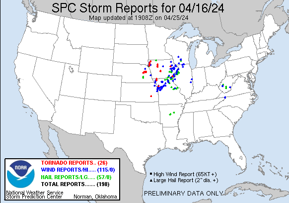
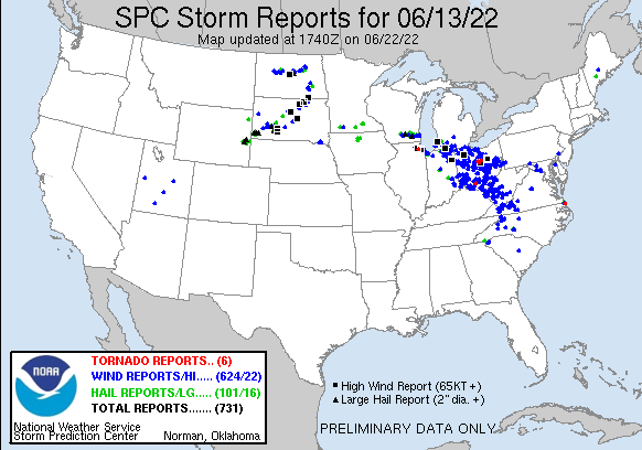
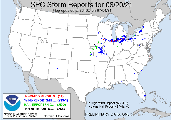
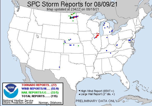
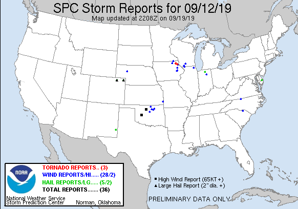
| Chase Statistics: Tornadoes: 0 Wind: 45-55MPH Hail: None | SPC Severe Weather Reports: 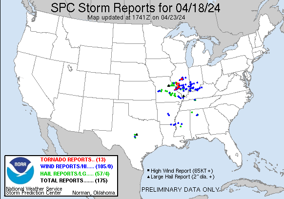 |
 RSS Feed