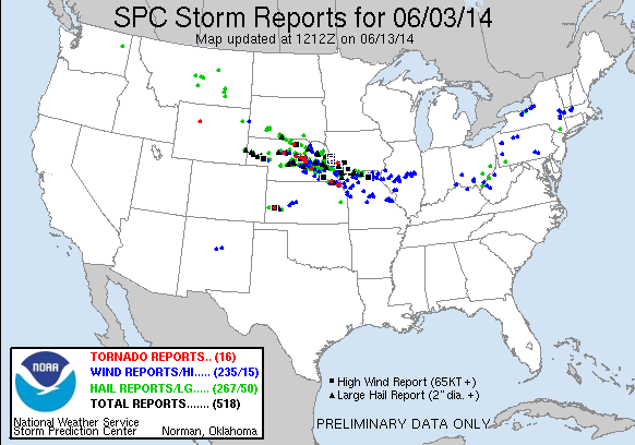
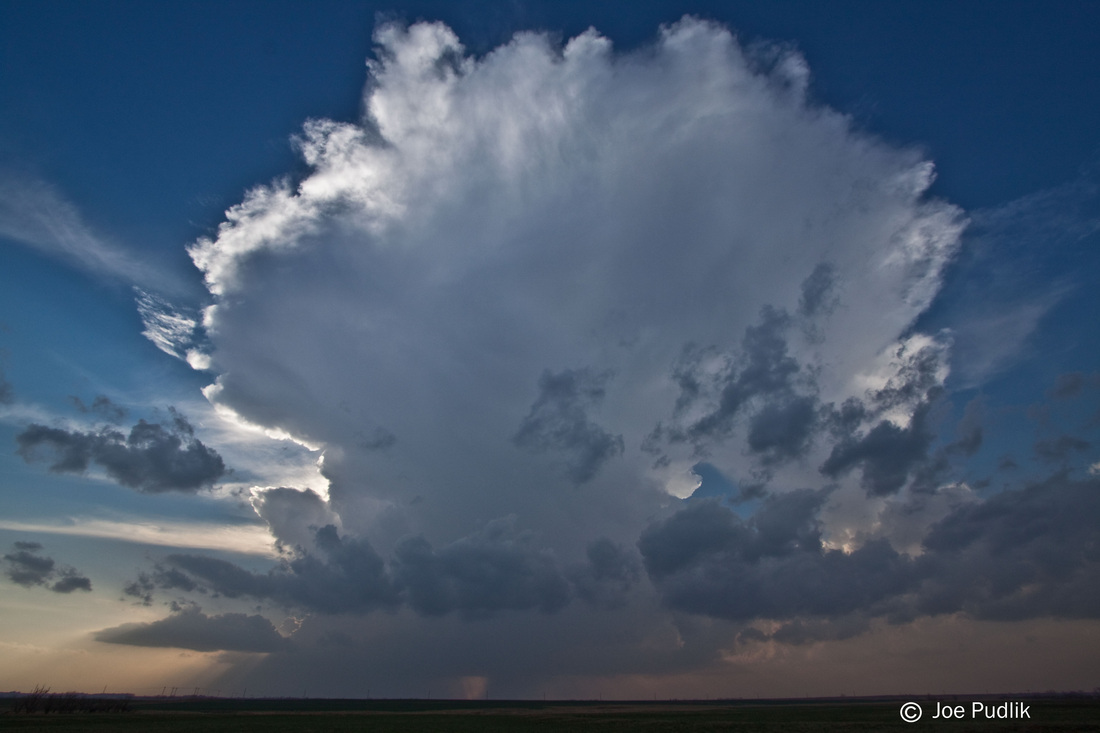
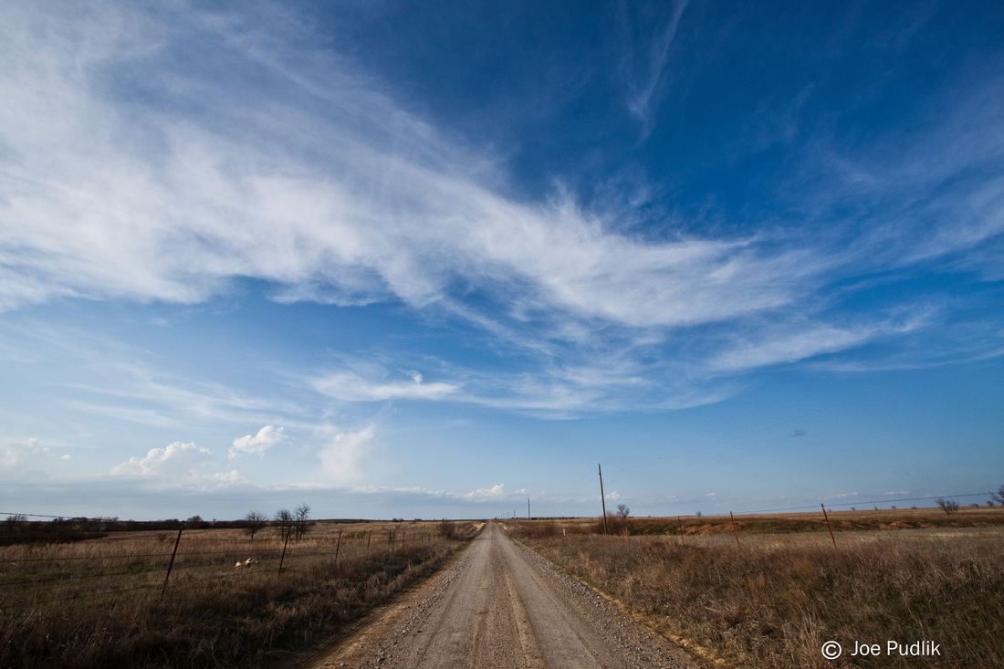
This day showed potential several days out. Leading up to the event there was several concerns including how early day convection would evolve, how much destabilization would occur in the wake of this activity, and potential cap (warm air aloft) issues.
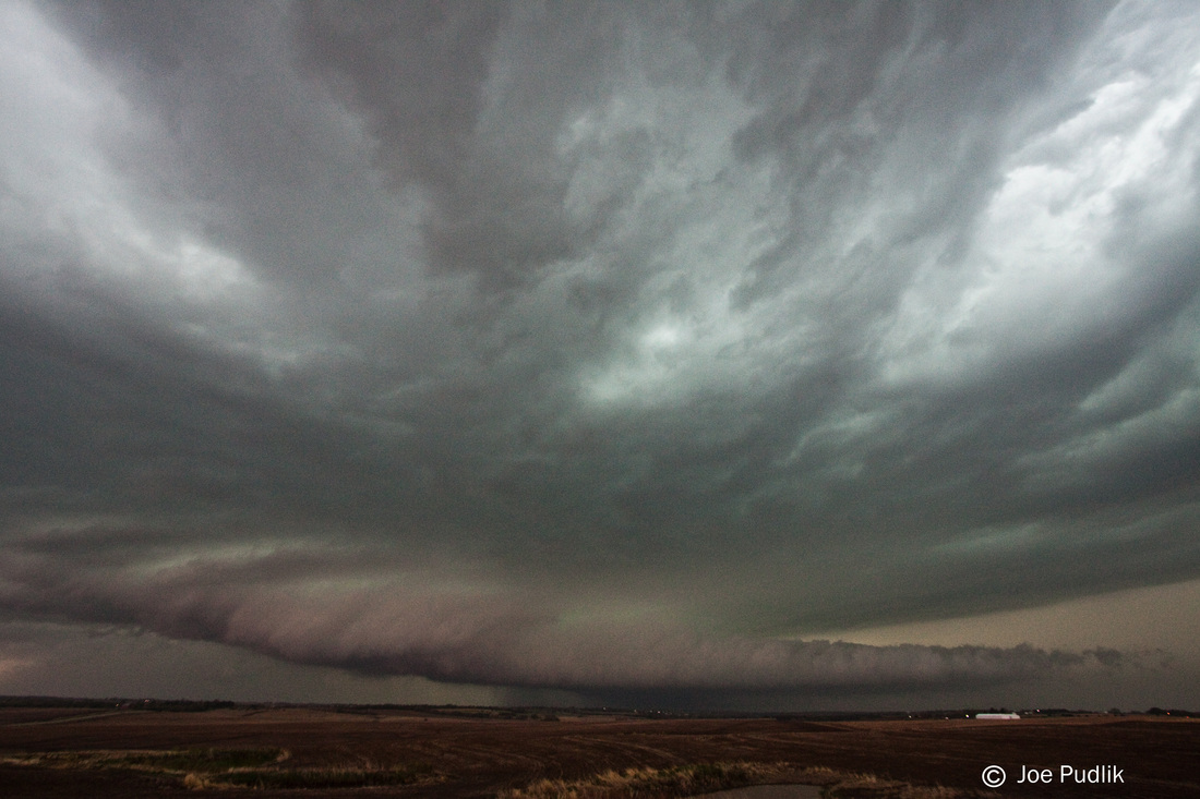
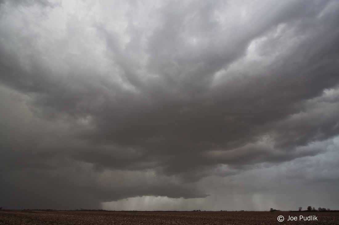
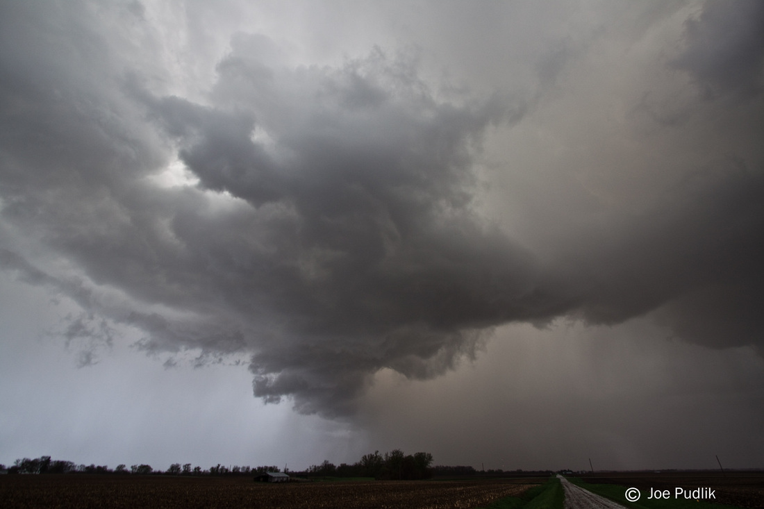
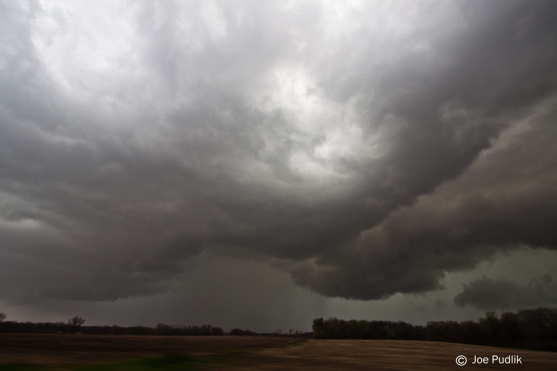
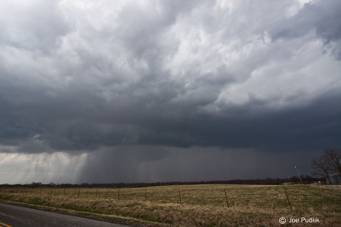
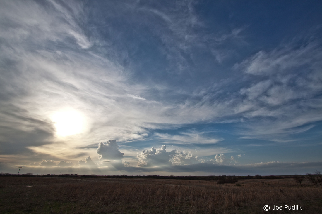
As we moved into the day of the event it was evident the cap was no longer likely to be a major concern, but instead a derecho that formed the previous night in South Dakota and moved across the Plains and into Wisconsin and Illinois during the morning would be an issue. The derecho quickly weakened mid-morning, but left behind widespread convective debris, in the form of widespread cloud cover along with scattered showers and storms. Even into the afternoon hours these issues persisted, with a cluster of severe storms in the Illinois/Iowa border area. Even with these issues, the environment was able to recover rapidly and significantly mid-late afternoon, and scattered storms developed mid-afternoon in Iowa. These storms pushed ESE, two of which moved into NW. Illinois. The dominant storm was located west of Sterling, IL and was moving ESE along a remnant outflow boundary from the early day activity.
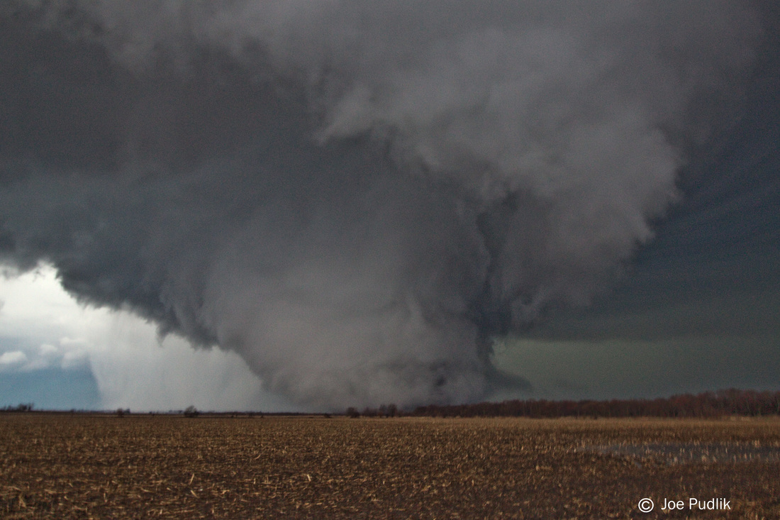
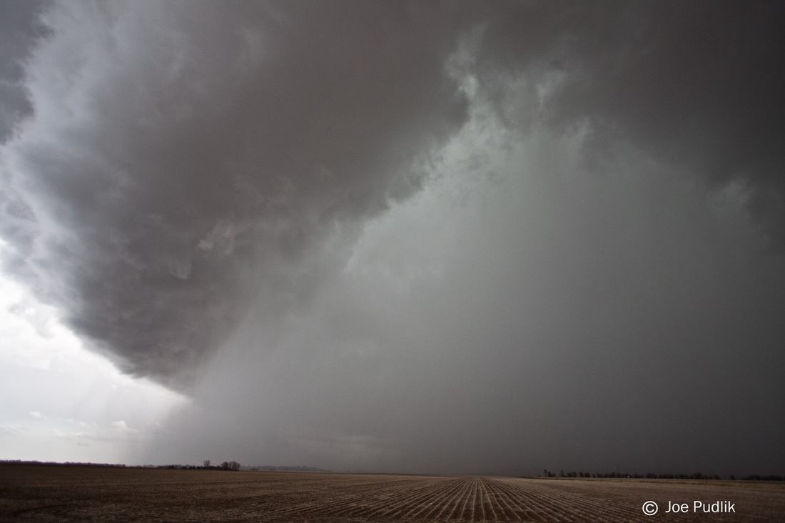
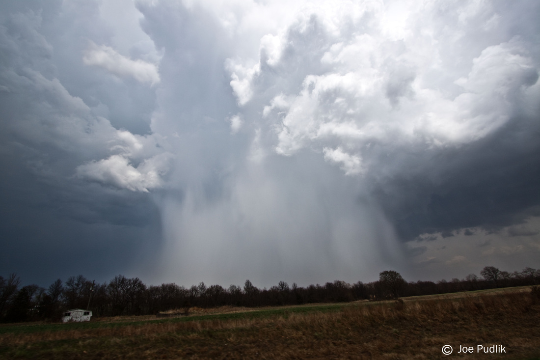
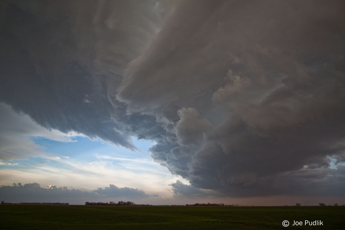
Before the storm was mature and was just showing signs of weak rotation, especially aloft, I was pondering whether or not to head out. It would be about a 1 hour and 45 minute drive from where I was at the time. I decided not to, but kept a watch on it. Eventually it was tornado warned, and I decided to pull the trigger and go out after it. At the time I was leaving the storm was still west of Sterling, IL and was turning into an HP supercell. After a quick stop home to get my gear I raced WSW to catch up to it. Along the way there were several tornado reports, and based on radar and reports, they were generally rain-wrapped.
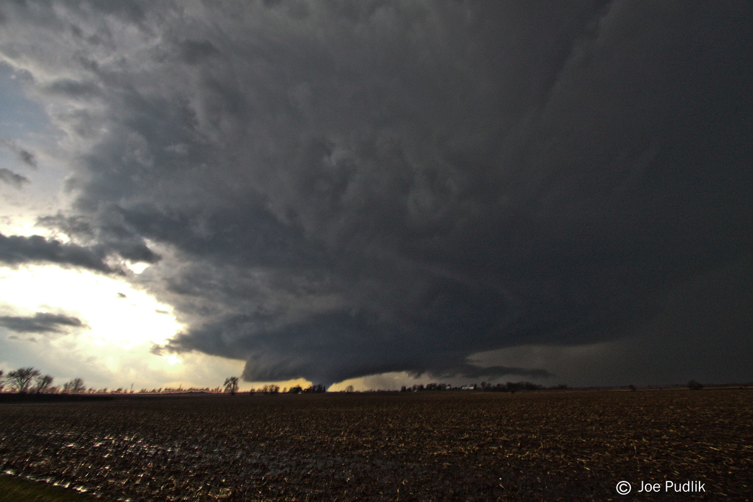
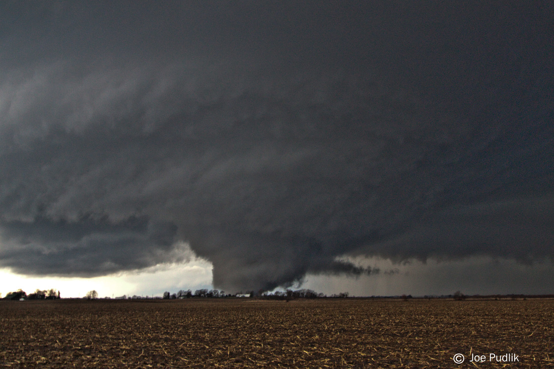
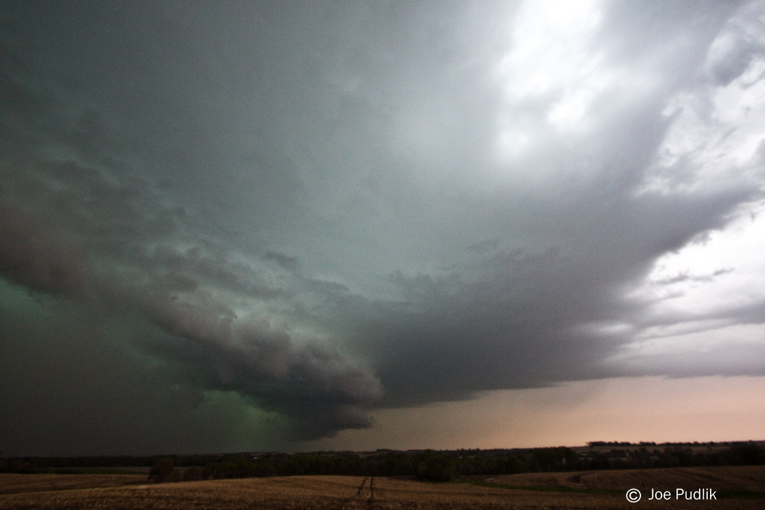
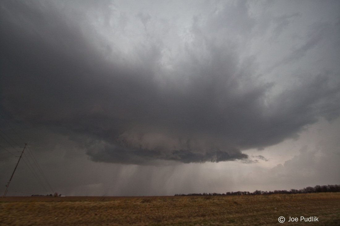
Diving southwest I made it to the far north side Ottawa, IL in time to find a spot to watch the storm move in. Constant lightning illuminated a nicely structured HP storm. Rotation became stronger with a better couplet showing up on radar just as the storm moved from my NNW to ENE. To my north there was a power flash, and at the time I thought I might have gotten a quick glimpse of a rain-wrapped tornado, but I was unsure.
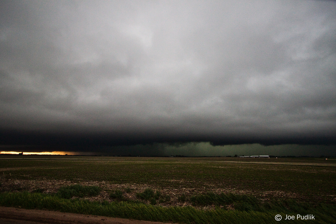
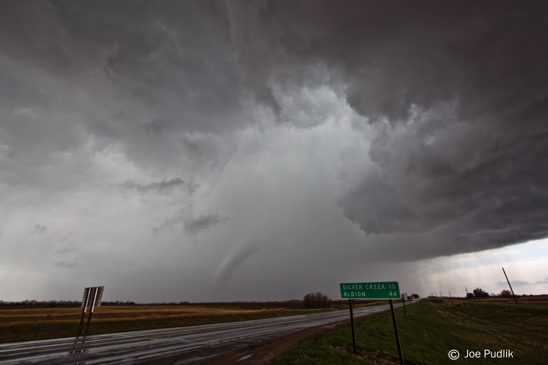
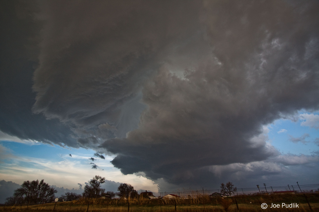
I ended up following the storm east on Route 6, with the main rotation being just a few miles to my north the whole time. I made it to Seneca, IL where I had to stop as the storm had pulled ahead of me a bit, and rotation had once again increase and was crossing the road a few miles ahead of me. At my location there was torrential rain and strong winds. I decided to call it a chase at this point, as I had gotten behind the storm, and a line of storms behind the supercell had also started to move through.
According to the NWS Chicago surveys there was indeed a confirmed an EF-1 tornado just north of where I was sitting in Ottawa, and would have been where I saw the power flash and thought I had a glimpse of the tornado. In addition to that, I captured the power flash on video, and it seems the power flash illuminates an object in the rain shield. Now whether that was the actually a tornado, scud, or heavier rain/hail, I'll never know for sure. Some pictures of this is below. Also, NWS Chicago confirmed and EF-1 tornado where the area of rotation crossed Route 6 a few miles ahead of me while sitting in Seneca.
Some video from this chase can be viewed below.
As we moved into the day of the event it was evident the cap was no longer likely to be a major concern, but instead a derecho that formed the previous night in South Dakota and moved across the Plains and into Wisconsin and Illinois during the morning would be an issue. The derecho quickly weakened mid-morning, but left behind widespread convective debris, in the form of widespread cloud cover along with scattered showers and storms. Even into the afternoon hours these issues persisted, with a cluster of severe storms in the Illinois/Iowa border area. Even with these issues, the environment was able to recover rapidly and significantly mid-late afternoon, and scattered storms developed mid-afternoon in Iowa. These storms pushed ESE, two of which moved into NW. Illinois. The dominant storm was located west of Sterling, IL and was moving ESE along a remnant outflow boundary from the early day activity.
Before the storm was mature and was just showing signs of weak rotation, especially aloft, I was pondering whether or not to head out. It would be about a 1 hour and 45 minute drive from where I was at the time. I decided not to, but kept a watch on it. Eventually it was tornado warned, and I decided to pull the trigger and go out after it. At the time I was leaving the storm was still west of Sterling, IL and was turning into an HP supercell. After a quick stop home to get my gear I raced WSW to catch up to it. Along the way there were several tornado reports, and based on radar and reports, they were generally rain-wrapped.
Diving southwest I made it to the far north side Ottawa, IL in time to find a spot to watch the storm move in. Constant lightning illuminated a nicely structured HP storm. Rotation became stronger with a better couplet showing up on radar just as the storm moved from my NNW to ENE. To my north there was a power flash, and at the time I thought I might have gotten a quick glimpse of a rain-wrapped tornado, but I was unsure.
I ended up following the storm east on Route 6, with the main rotation being just a few miles to my north the whole time. I made it to Seneca, IL where I had to stop as the storm had pulled ahead of me a bit, and rotation had once again increase and was crossing the road a few miles ahead of me. At my location there was torrential rain and strong winds. I decided to call it a chase at this point, as I had gotten behind the storm, and a line of storms behind the supercell had also started to move through.
According to the NWS Chicago surveys there was indeed a confirmed an EF-1 tornado just north of where I was sitting in Ottawa, and would have been where I saw the power flash and thought I had a glimpse of the tornado. In addition to that, I captured the power flash on video, and it seems the power flash illuminates an object in the rain shield. Now whether that was the actually a tornado, scud, or heavier rain/hail, I'll never know for sure. Some pictures of this is below. Also, NWS Chicago confirmed and EF-1 tornado where the area of rotation crossed Route 6 a few miles ahead of me while sitting in Seneca.
Some video from this chase can be viewed below.
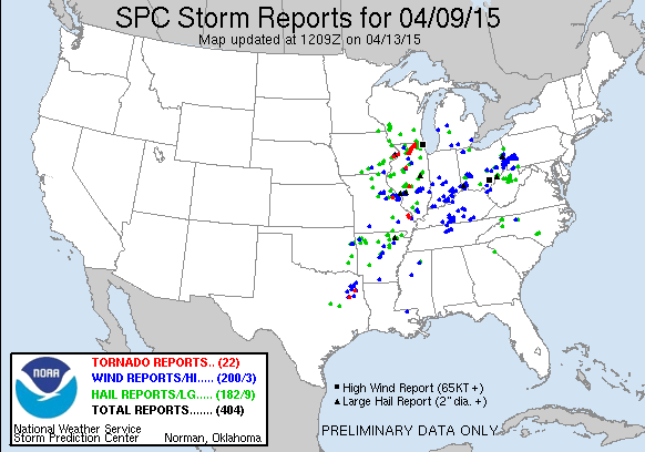
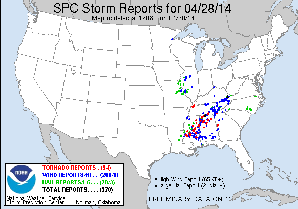
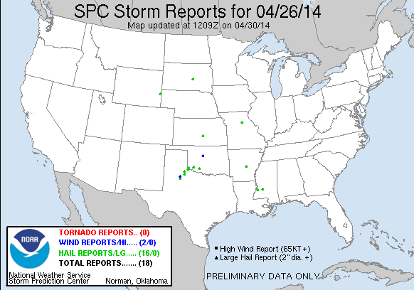
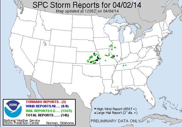
| Chase Statistics: Tornadoes: 1 Wind: 50-60MPH Hail: None | SPC Severe Weather Reports: 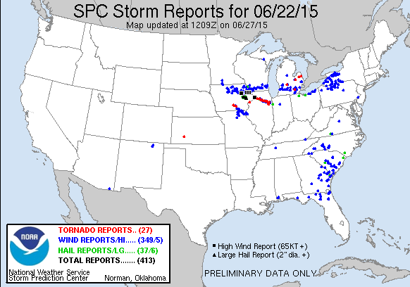 |


 RSS Feed